
Last article was on December 16th for you in Arizona here at Arizona Weather Force (CLICK HERE) and that did called a 9 day forecast and I quote, “I do not see anything to stop storm chances on Christmas Eve through Christmas Day. It is a very active pattern and numbers this far out are very wild. One of these systems will have arctic air entrained into it an you can bet the Central/Northern Arizona Mountains will see heavy snowfall and high snow amounts so if you have houses/cabins up there you will have a 100% chance of a White Christmas.” You did have your White Christmas today in the mountains so you are welcome. Well ? That article said Christmas through New Years so let’s get on with this forecast by reading on …
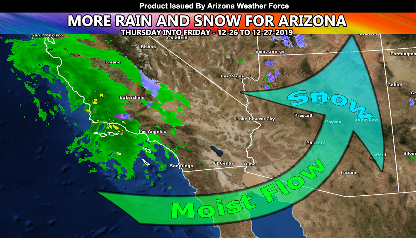
Another system will hit tomorrow (Thursday) and last through some of Friday as well. It will produce yet another round of heavy rainfall for the low elevations and heavy snowfall for the top areas. The maps below are from the Southern California Weather Force Rain and Snowfall forecast model. It truly is a unique view at weather. This band may have isolated thunderstorms on Thursday for Southwest/Southern Arizona, but other than that I do not see much in the way of thunderstorm dynamics over a large area. If you get one, awesome… if not.. no biggie. So to put it plain, here is what the maps below show.
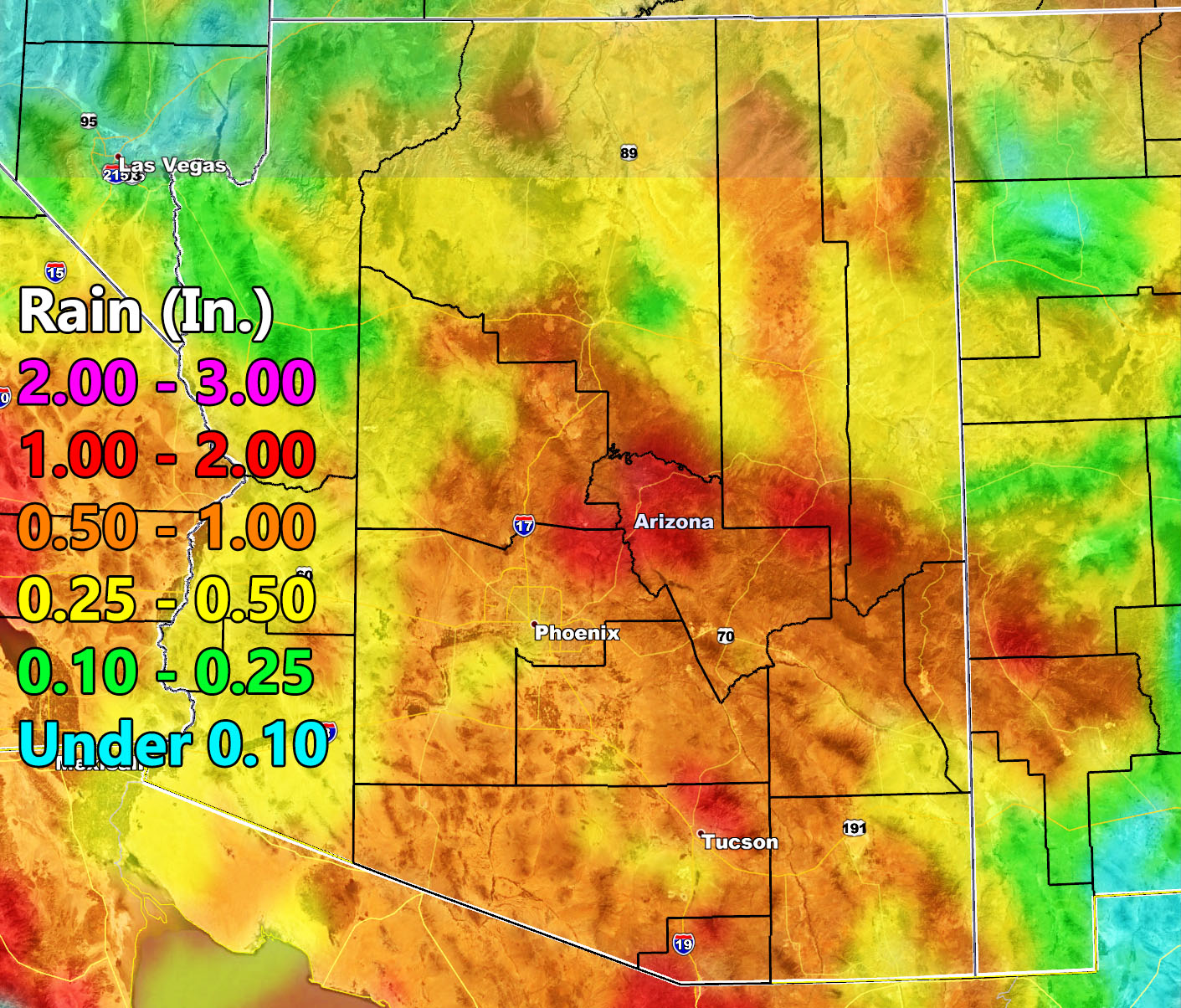
Rainfall forecast:
Phoenix – 0.50-1.00″ surrounding metro with 0.25 to 0.50″ metro proper
Tucson – 0.50-1.00″ with hints of 1.25″ and 1-2″ Oro Valley
Kingman – 0.10-0.25″
Yuma – 0.25-0.50″
Quartzsite – 0.25-0.50″
Wilcox – 0.50-1.00″
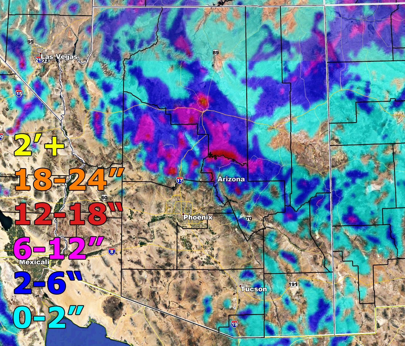
Snowfall forecast:
Flagstaff – 6-12″
Payson – 2-6″
Prescott – 6-12″ with 2-6″ Chino Valley
Show Low 2-6″ but parts are closer to 2-4″
Grand Canyon Village – 2-6″ with 6-12″ surrounding the highway south and east of it.
After this passes we have yet another system for the 30th into the 31st. I’ll try to get it out of there before New Years Eve parties and the stroke of midnight so stay tuned to Arizona Weather Force
NOTE: This is the SCWF Website but it is being used for national updates until a suitable national website can be developed for you.
Your Facebook Page to join for this update is linked here – https://www.facebook.com/ArizonaWeatherForce
Reading for another state? Find your region I serve here – https://www.facebook.com/nwfweather/photos/a.643550279121473/1544547759021716