
Southern California Weather Force has issued the final forecast for rain, snow, and wind projections within the strong storm system that has been expected here within the Raiden Storm Pattern so read on for details …
WANT THESE DELIVERED WITH ALL THOSE PERKS INCLUDING BEING ON THE MICRO-CLIMATE ALERT SYSTEM AND MODELS DURING EVENTS BECAUSE NOT EVERY ALERT IS POSTED ON SOCIAL MEDIA FROM THIS WEATHER OFFICE – JOIN TODAY BY CLICKING HERE – Southern California Weather Force Subscriber System – Southern California Weather Force
Join the Facebook Page for Further Updates If You Have Not Yet!
SOUTHERN CALIFORNIA WEATHER FORCE MAIN:
A few days ago, the Southern California Weather Force Flood Watch was issued for all metro areas, with parts of the High and Low Desert in on the action as well. Click here for that article. There really is not much of a change from the previous forecast so I will go ahead and post parts of that right now, only tweaking a bit of the details around.
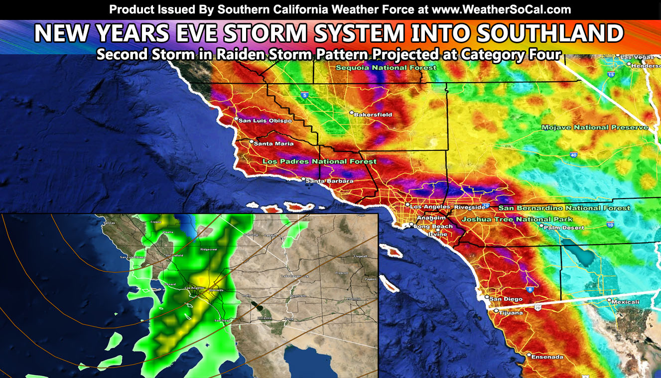
The next storm front will be stronger than the one we just had. We can consider the one we just had a category two out of six within the Southern California Weather Force category system, which was developed in 1999 to measure a storm system’s inner dynamics and bring the number to the public for severity and planning.
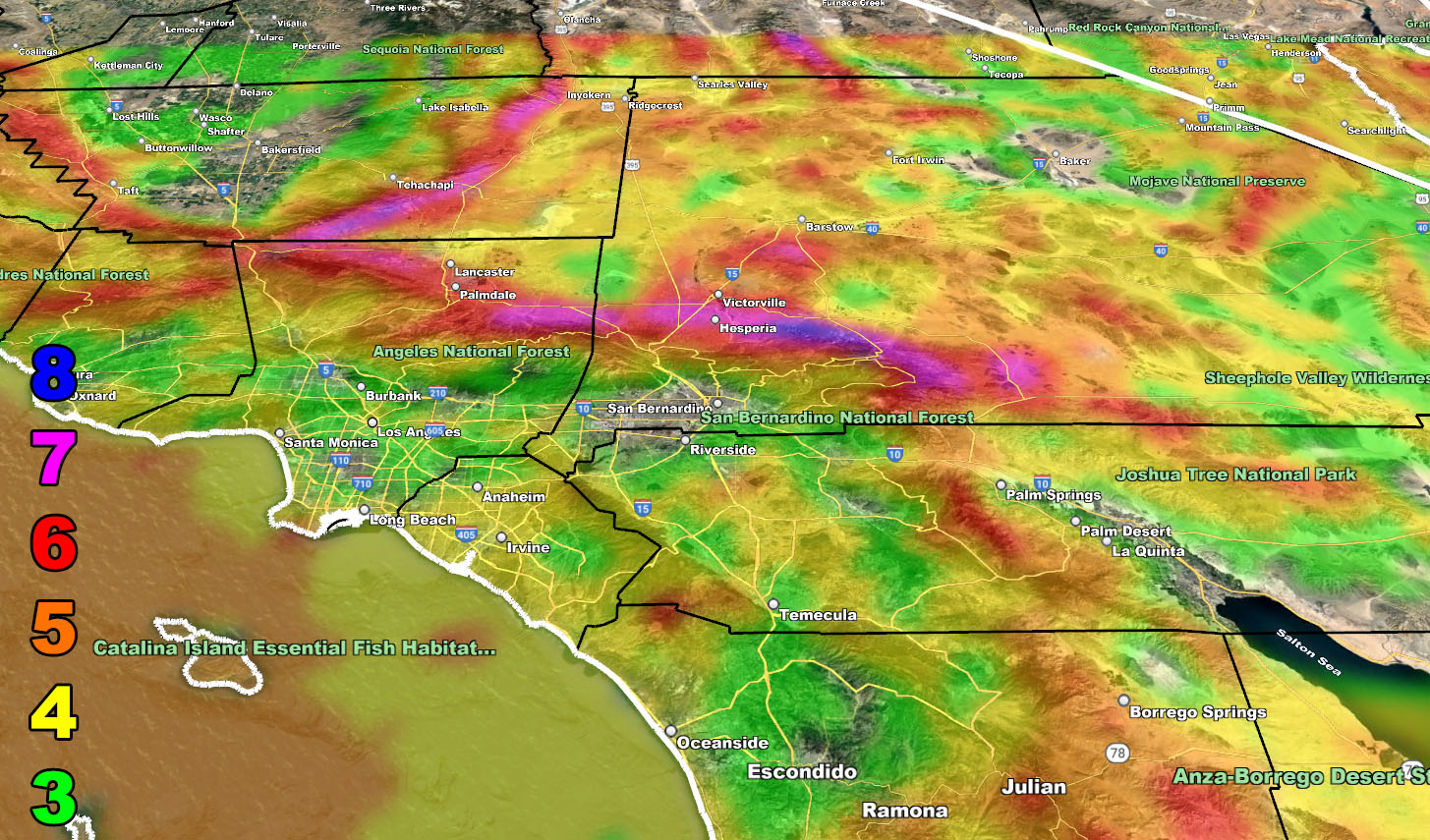
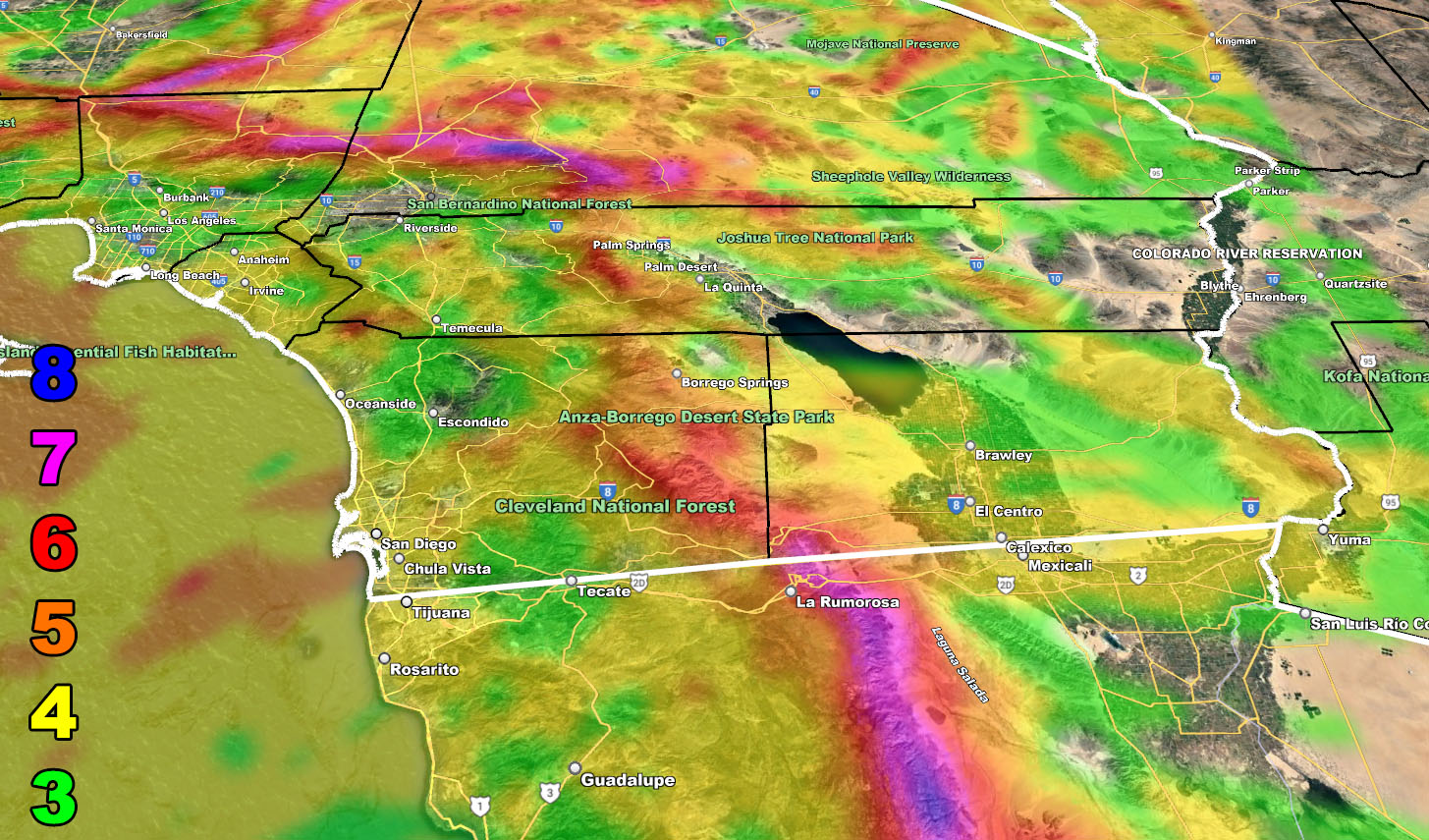
This next storm, within the current Raiden Storm Pattern, has been assigned a category four out of six here at Southern California Weather Force. A category four means that high winds along the frontal zone will be likely, along with torrential downpours. Winds like this can easily bring trees down along this front, especially in areas like Los Angeles, Orange and San Diego County, where the strongest of the winds will be later on New Years Eve. If you plan to be parked at a party, consider parking away from where a tree would fall. Winds will be from the south and west to the north and east mainly so parking on the south or west side of a tree gives you the better chance it does not fall in your direction.
The winds will continue strong in the San Diego forecast zones for most of the day on New Years due to a continued strong low-level flow off the ocean, being west to east.
Timing of this main front will be as followed;
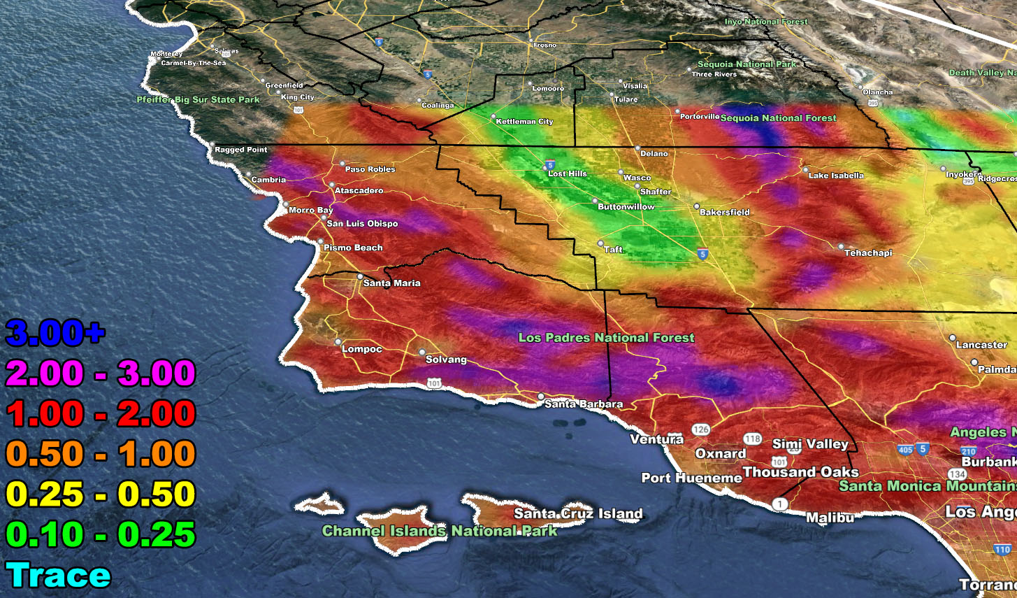
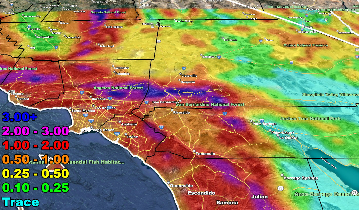
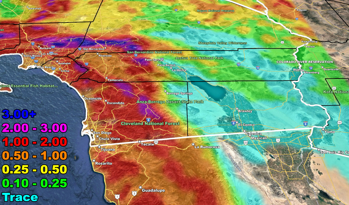
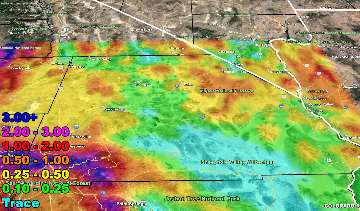
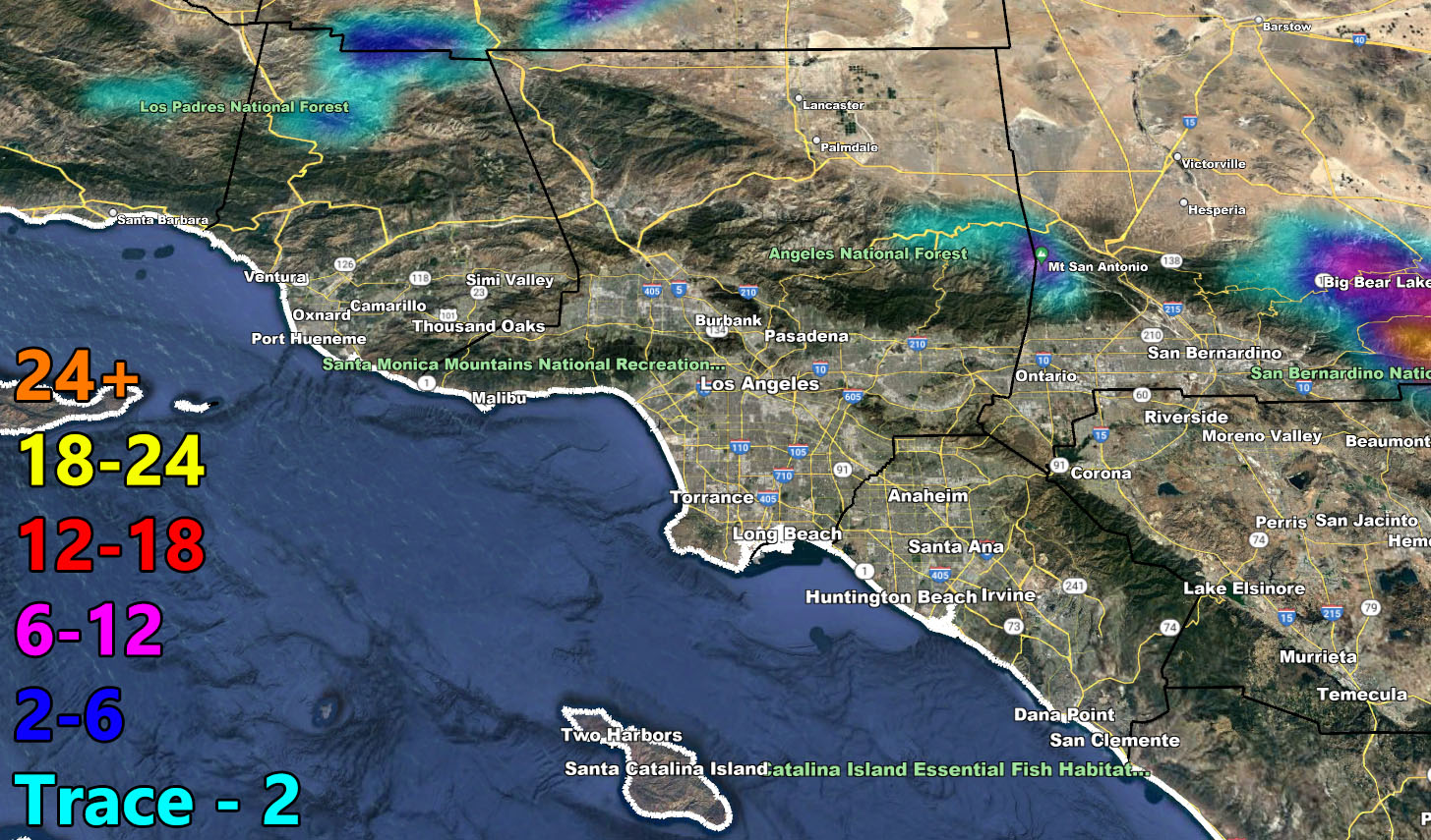
San Luis Obispo / Santa Barbara County will be hit during the evening, followed by the rest of the forecast area through Ventura, Los Angeles, Orange, San Diego, and the Inland Empire zones during the night-time period as well as all neighboring mountain zones into the High Desert as well.
The deep-layer moisture will allow this to cross into the Coachella Valley as well, where I expect heavy rain to be somewhere after the new year strikes 12. This band will extend into the Las Vegas Metro zones as well, a zone within the Southern California Weather Force jurisdiction, therefore you do have a Flood Watch as well.
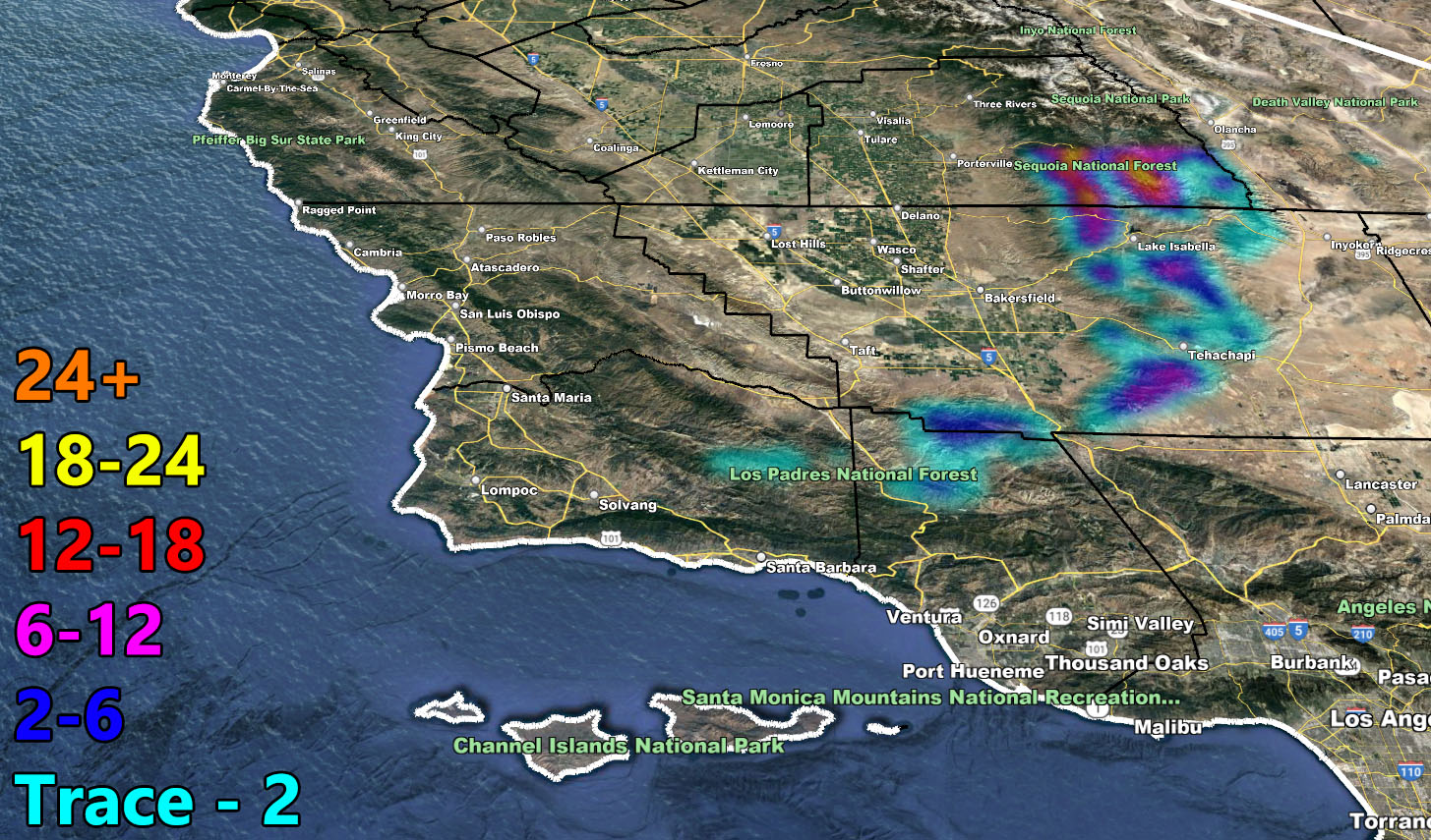
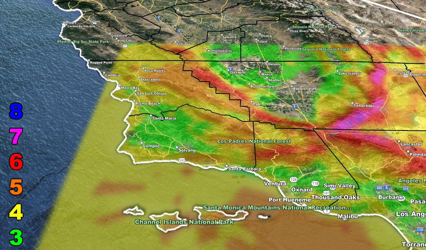
SNOW: Snow-levels will be high, above 7,500 FT for the main part of the frontal zone, crashing through 6,000 toward the end. Any residual will put some snow in the Big Bear Lake forecast area, with higher amounts in Upper Moonridge than the lake level. We could see some areas between 3-6″ given the cold air filter in toward the end of the front on New Years Day. Any residual would put off and on snow showers in those same areas through the day.
THUNDERSTORMS: Isolated thunderstorms are possible along the front for parts of Los Angeles, Orange, and the Inland Empire zones, but it is not at the moment a major concern. What can happen is as the frontal zone leaves San Diego, cold air aloft can filter in on New Years Morning and create an elevated chance of thunderstorms down there in a small sector of the forecast zone. Enough instability, lift, and moisture does exist for the chance to be warranted.
MEDIUM RANGE: Another system will hit early this next week, another toward mid/end week as we remain within the storm pattern that has stretched all the way to Asia. The ones this next week will be colder than the ones now, so I do expect resort-level snowfall with them. Amounts are TBD.
LONG RANGE: This is a Raiden Storm Pattern. Since the name of the predictor weeks ago is Raiden Storm, like a novel or discovering a comet, the pattern is always named after the discoverer as forecasting weather seems to be a gray area where others do not credit the original author, so the storm pattern system has been implemented when needed. We will continue through the first half of January within the Raiden Storm Pattern, amassing a lot of needed rainfall and upping the seasonal totals. As predicted over 4-6 months ago here at Southern California Weather Force, this season would be wetter, not drier. This can be viewed on the final forecast by Clicking Here.
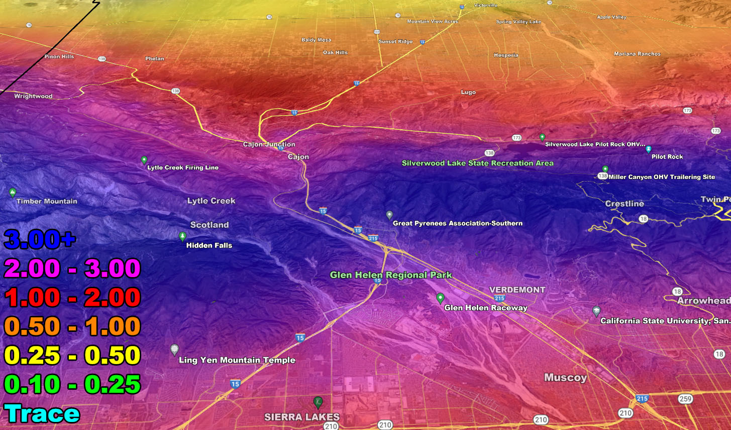
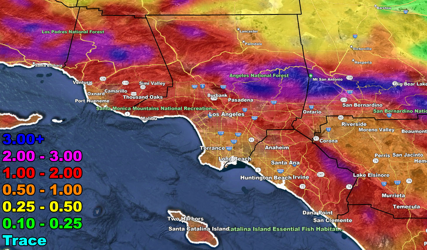
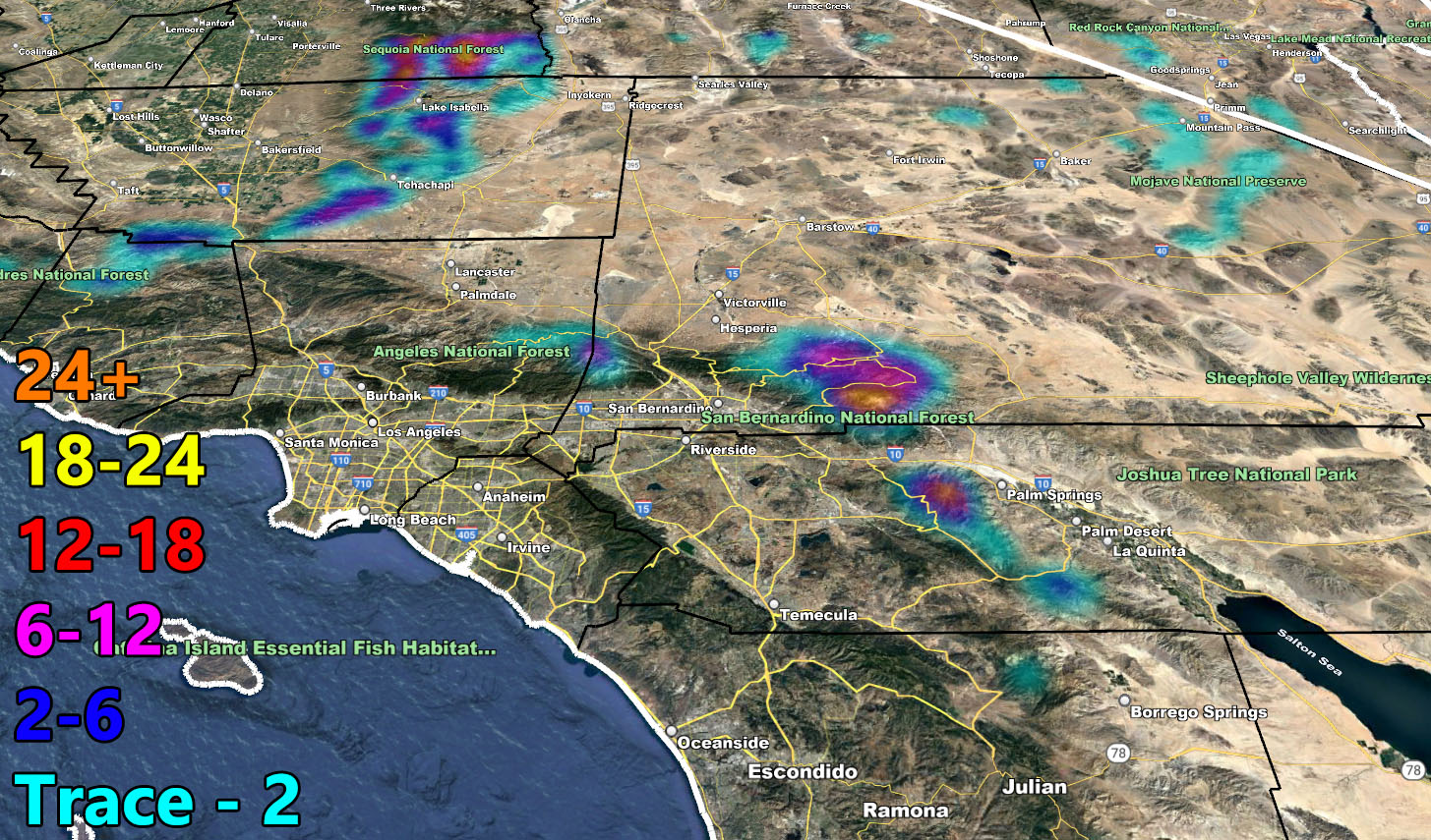
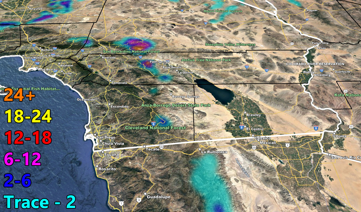
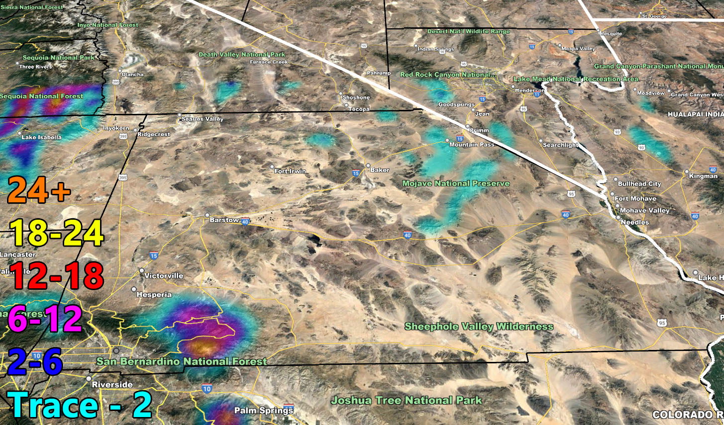
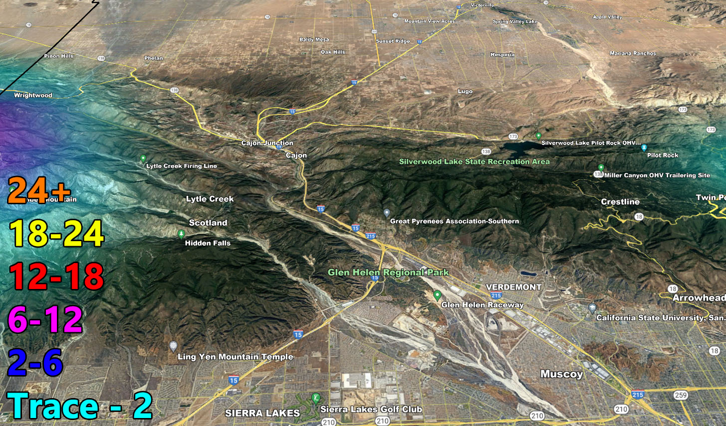
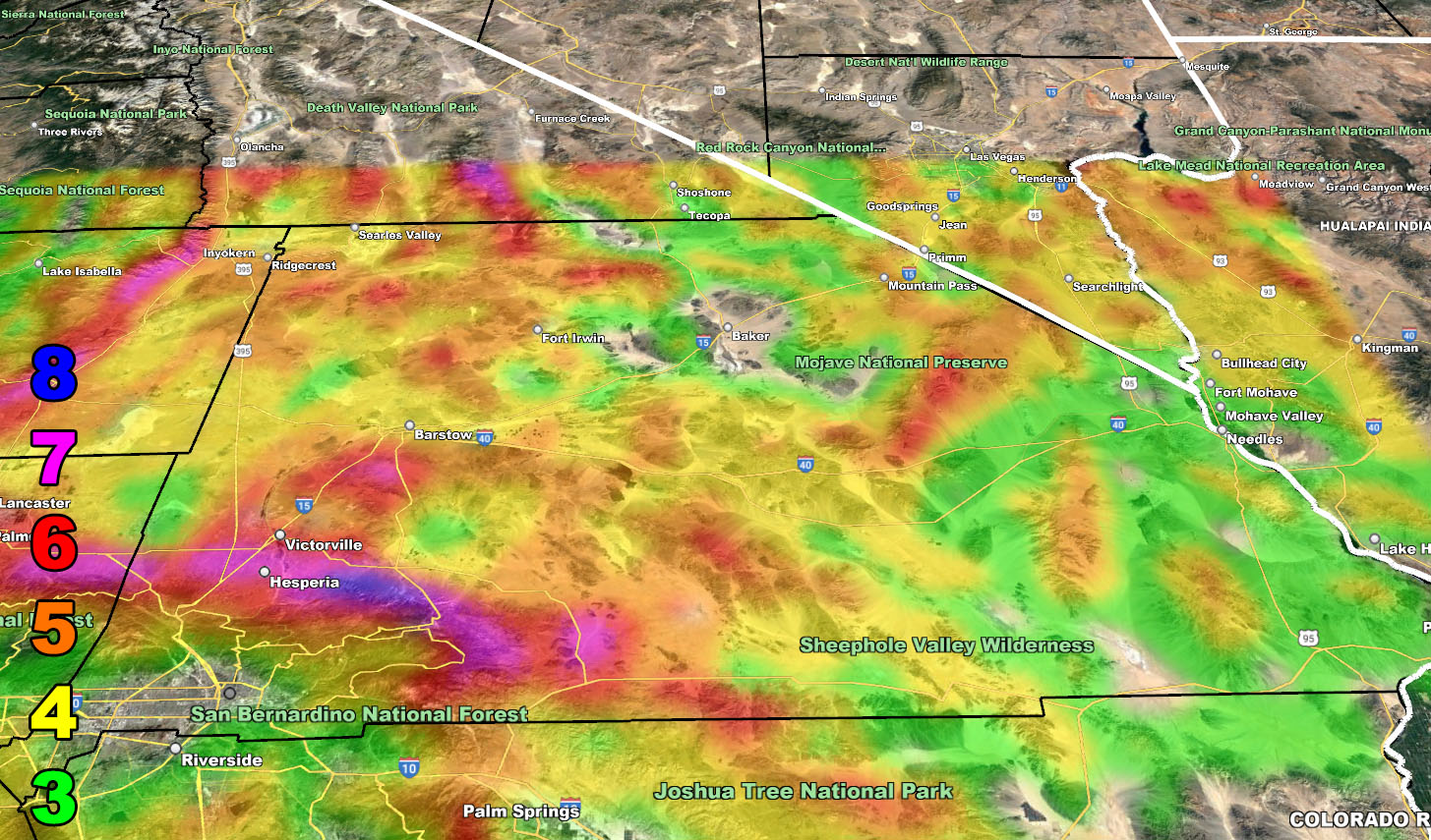
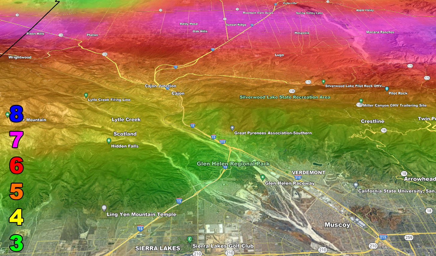
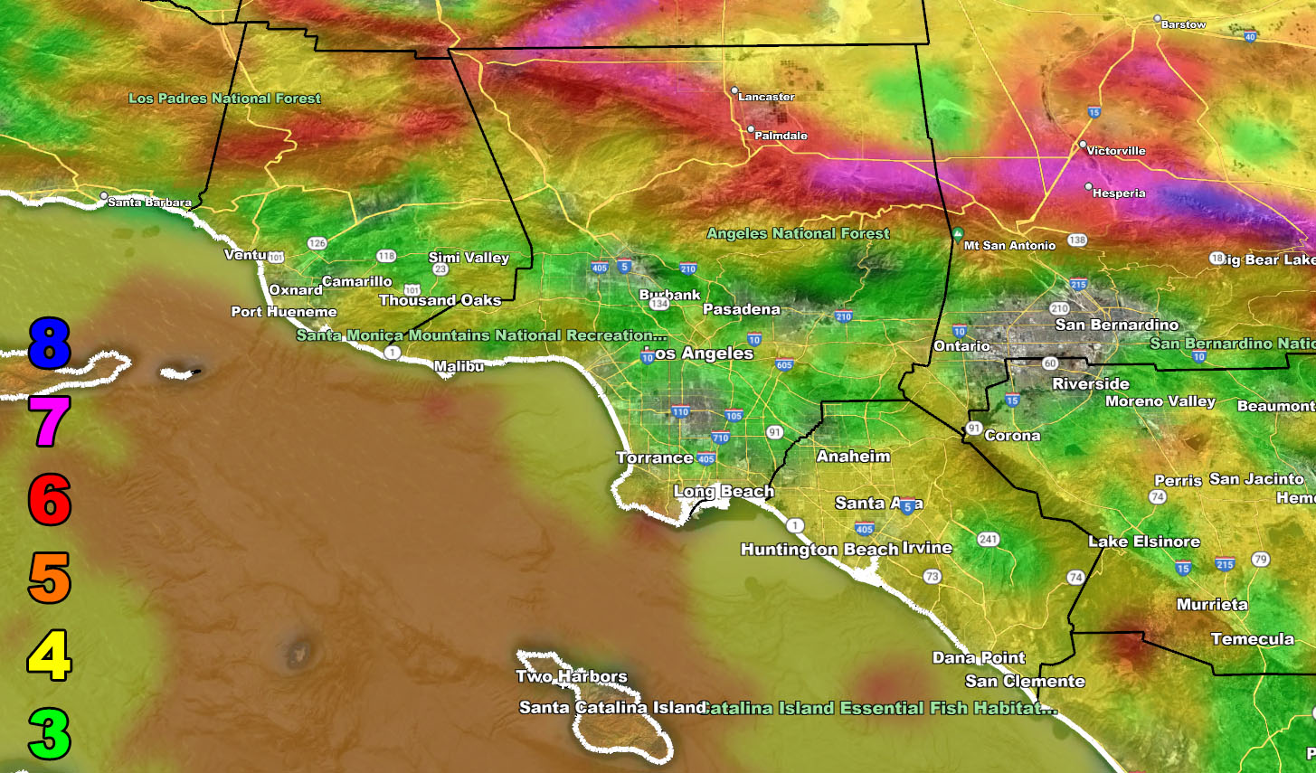
Below are the SCWF models for rain, snow, and wind for this event.
Rain Model – VALID TODAY INTO NEW YEARS DAY
SUPPORTING MEMBERS: Click Here To See The GPS Version Of This Model In Your Member Section Tab.
Snow Model – VALID TODAY INTO NEW YEARS DAY
SUPPORTING MEMBERS: Click Here To See The GPS Version Of This Model In Your Member Section Tab.
Wind Model – VALID TODAY INTO NEW YEARS DAY
SUPPORTING MEMBERS: Click Here To See The GPS Version Of This Model In Your Member Section Tab.
Raiden Storm Wind Gust Intensity Scale –
8. Extensive widespread damage.
7. Trees are broken or uprooted, building damage is considerable. – High Profile Vehicle Roll-Over CERTAIN.
6. SOME Trees are broken or uprooted, building damage is possible. – High Profile Vehicle Roll-Over Likely, Do NOT recommend Traveling in this zone. This zone also is the starting zone where trees and powerlines will fall and damage cars and even kill people near or in them!
5. Slight damage occurs to buildings, shingles are blown off of roofs. HIGH WIND WARNING CRITERIA – High Profile Vehicle Roll-Over Possible if weight is not corrected.
4. Twigs and small branches are broken from trees, walking is difficult.
3. Large trees sway, becoming difficult to walk. POWER SHUTDOWN THRESHOLD DURING FIRE WEATHER / WIND ADVISORY CRITERIA
WANT THESE DELIVERED WITH ALL THOSE PERKS INCLUDING BEING ON THE MICRO-CLIMATE ALERT SYSTEM AND MODELS DURING EVENTS BECAUSE NOT EVERY ALERT IS POSTED ON SOCIAL MEDIA FROM THIS WEATHER OFFICE – JOIN TODAY BY CLICKING HERE – Southern California Weather Force Subscriber System – Southern California Weather Force
Join The Main Southern California Weather Force Facebook Group (50 percent delivery time) – You can join the main SCWF page as well through that group.
Click Here To Join The Page Today