
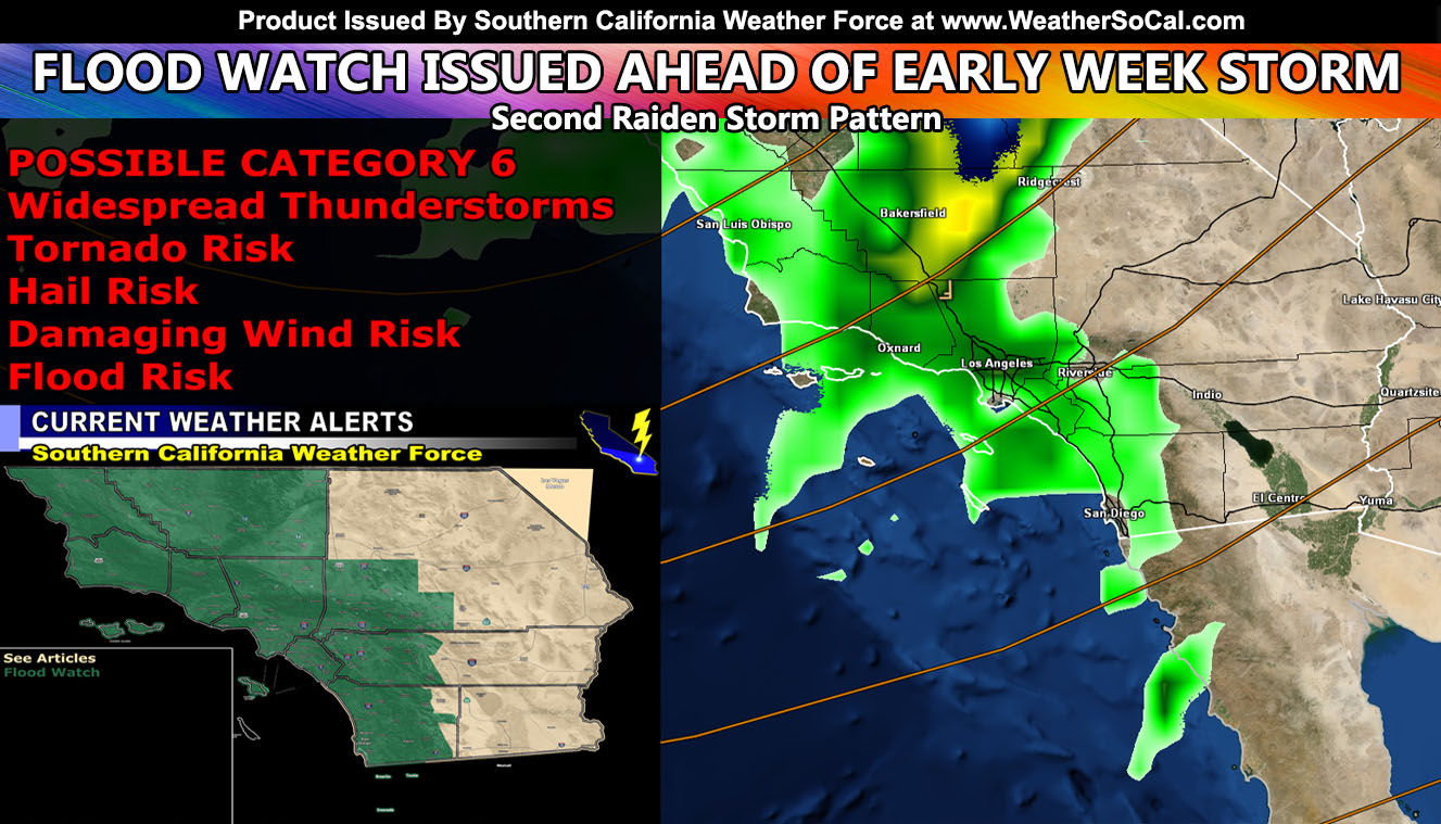
Southern California Weather Force has issued a Flood Watch effective later Monday into mainly Tuesday. This watch comes scheduled after the Long-Range Weather Warning back on January 5th was issued so read on for details as this system will sure to be filled with thunderstorms, some severe with elevated tornado dynamics. This system will be assigned a start of a Category Five out of Six, but I am leaving room for a possible upgrade to Category Six once the severe storm numbers are crunched so read on for details …
The Long-Range Weather Warning issued back on January 5th outlined the coming storm pattern. After a brief lull, the second Raiden Storm Pattern is about to hit the forecast area, bringing heavy rain, gusty winds, and even a high-risk thunderstorm event. Click here for that earlier warning article.
As quoted in the article, “The storm intensifies on Monday night, finally getting shoved eastward for a direct impact on all regions of the forecast area by Tuesday. This system looks very interesting as per meteorological terms it is known as a negative-tilt system. A negative-tilt system means that colder air aloft will be ahead of the front, something we rarely see. Thunderstorm dynamics will be elevated with this system along the frontal zone, that of which we have not seen yet this season.”
One thing I am watching is the amount of surface instability that will accompany the frontal zone on Tuesday. This easily has the low-level dynamics to introduce tornado probabilities, especially from SLO, Santa Barbara, Ventura, Los Angeles, and Orange County. In addition to that, waterspouts, some strong and large, will be likely as well so activities on the water will not be recommended.
Southern California Weather Force once again will officially be giving the convective (thunderstorm) statements as the time comes, whether it be issuing a Severe Thunderstorm or Tornado Watch alert so stay tuned to future forecasts.
LONG RANGE: Another system will come on the weekend of January 14th.
WANT THESE DELIVERED WITH ALL THOSE PERKS INCLUDING BEING ON THE MICRO-CLIMATE ALERT SYSTEM AND MODELS DURING EVENTS BECAUSE NOT EVERY ALERT IS POSTED ON SOCIAL MEDIA FROM THIS WEATHER OFFICE – JOIN TODAY BY CLICKING HERE – Southern California Weather Force Subscriber System – Southern California Weather Force
Join The Main Southern California Weather Force Facebook Group (50 percent delivery time) – You can join the main SCWF page as well through that group.
Click Here To Join The Page Today