
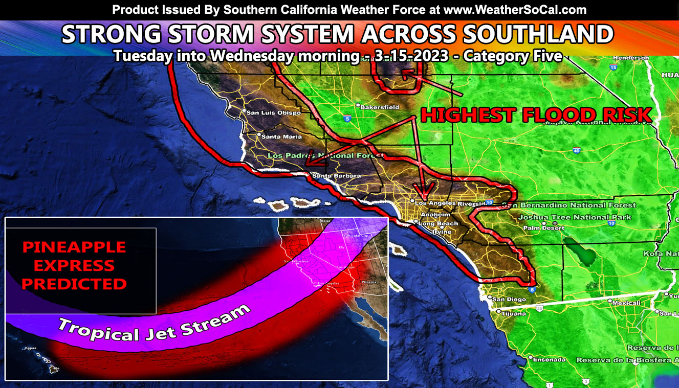
Southern California Weather Force will maintain the category of the coming impulse as a category five out six within the scale designed for Pacific Storm Impacts. This is a very similar system to the last one in various zones, which means more flooding is likely along with a loss of life if one does not listen to these forecasts. This forecast is exactly the same as yesterday’s forecast so the only thing different is those rain maps so read on …
First, I will say if you have not already seen the ‘Weather Center Support’ greeting at the lower right of your screen then that is a new feature being tested that will have various things for members and non-members. I will be adding more in time so check back.
Join the Facebook Page for Further Updates If You Have Not Yet!
SOUTHERN CALIFORNIA WEATHER FORCE MAIN:
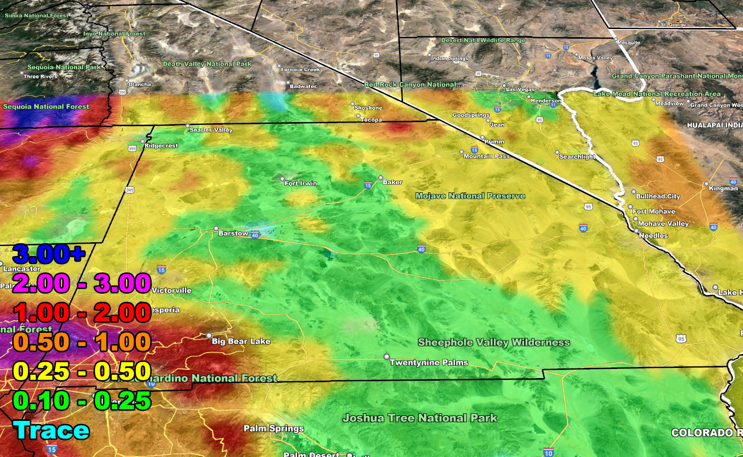
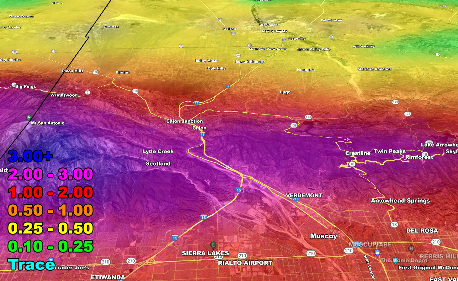
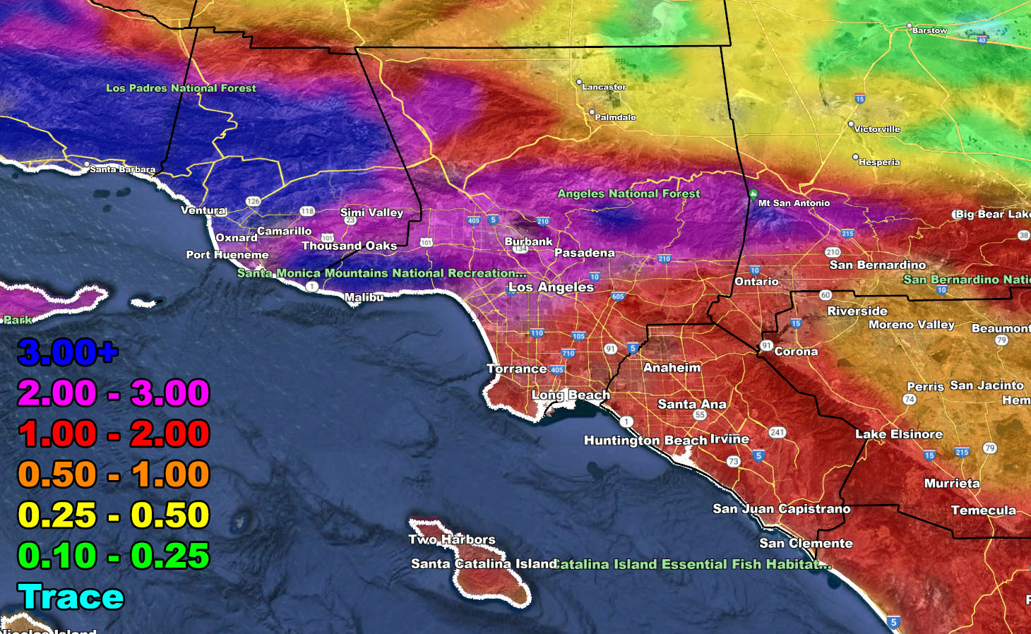
At the time of this write-up, a stream of tropical moisture is making its way to California, with a Tuesday impact across the state. Southern California Weather Force risk assessment models continue to have an extreme category risk for San Luis Obispo, Santa Barbara, Ventura, and Los Angeles County, minus the deserts. It also stretches a categorical extreme value into the Lake Isabella and Kernville areas of the Northern Tehachapi Mountain Range.
Here are the final keynotes;
- This event is Tuesday into Wednesday, but there are indications that Wednesday for most of the day will clear out fast during the morning hours.
- Category Five conditions will only be for areas I listed above, mostly due to heavy rain into flood hazards.
- The front will remain strong, but not as strong for areas like San Diego or some of the Inland Empire. You still will have heavy rainfall.
- Snow-levels will be high, and we will have more snowmelt in the Los Angeles and San Bernardino Mountains than the last one.
- Strong winds will hit the SLO/Vandenberg areas on Tuesday, which also will be for all mountain and desert zones.
- Strong winds will NOT hit along the front for any metro areas besides SLO/SBA.
- Southern California Weather Force Avalanche Watch issued on March 9th remains in effect – Click here to read that
- Flood Watches from this office are now in effect for all areas of the forecast area in the mountains and south and west, which includes all metro zones.
- The Kern River will be raging again, get away from it.
LONG RANGE: We are NOT done with the storms. We may very well have another storm pattern after the 20th, as previously stated in other articles before this one. The pattern remains out of the Pacific and if that happens, another strong system will be in Southern California then, probably targeting between March 21st and 23rd. After that is when nature will try to calm itself as we head toward April, a month not known for major storms here.
This entire event is from a follow-up to two articles, one from March 1st calling the pattern into California (Click Here), and the other a follow-up to that one for the Pineapple Express wording, which can be found by Clicking Here.
Use the information source below for this storm;
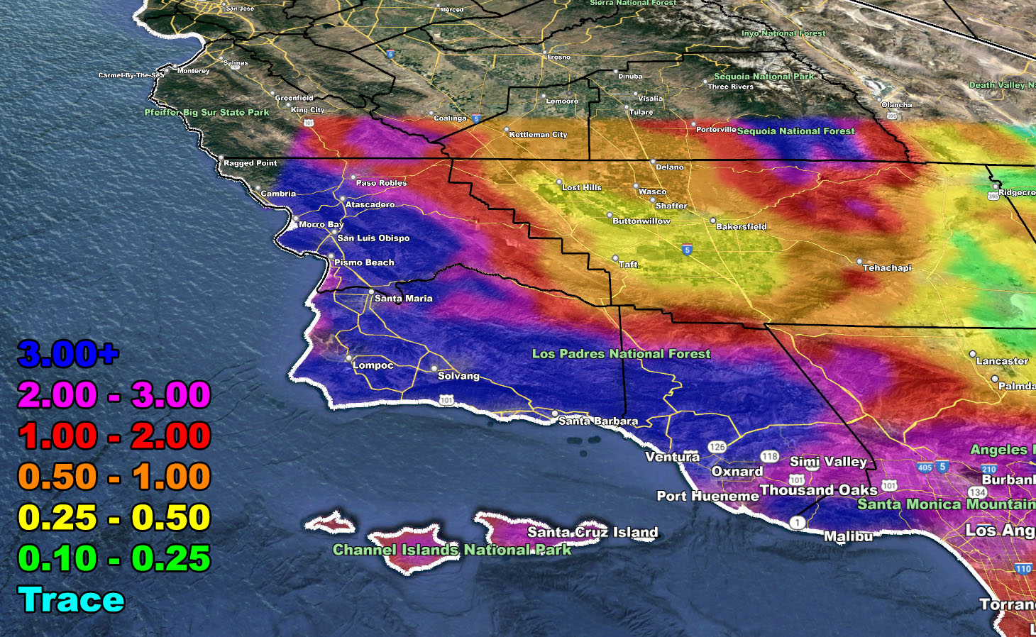
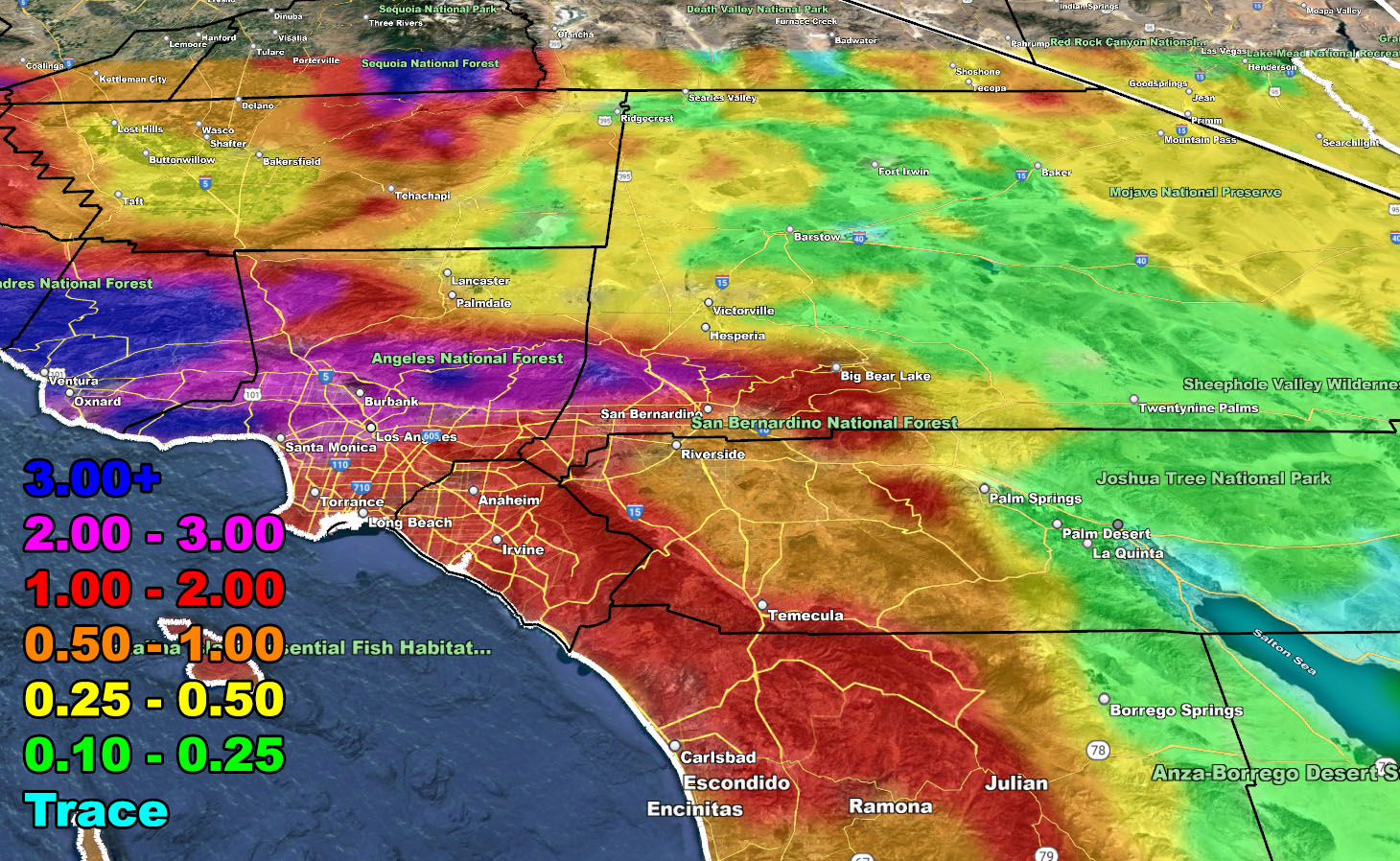
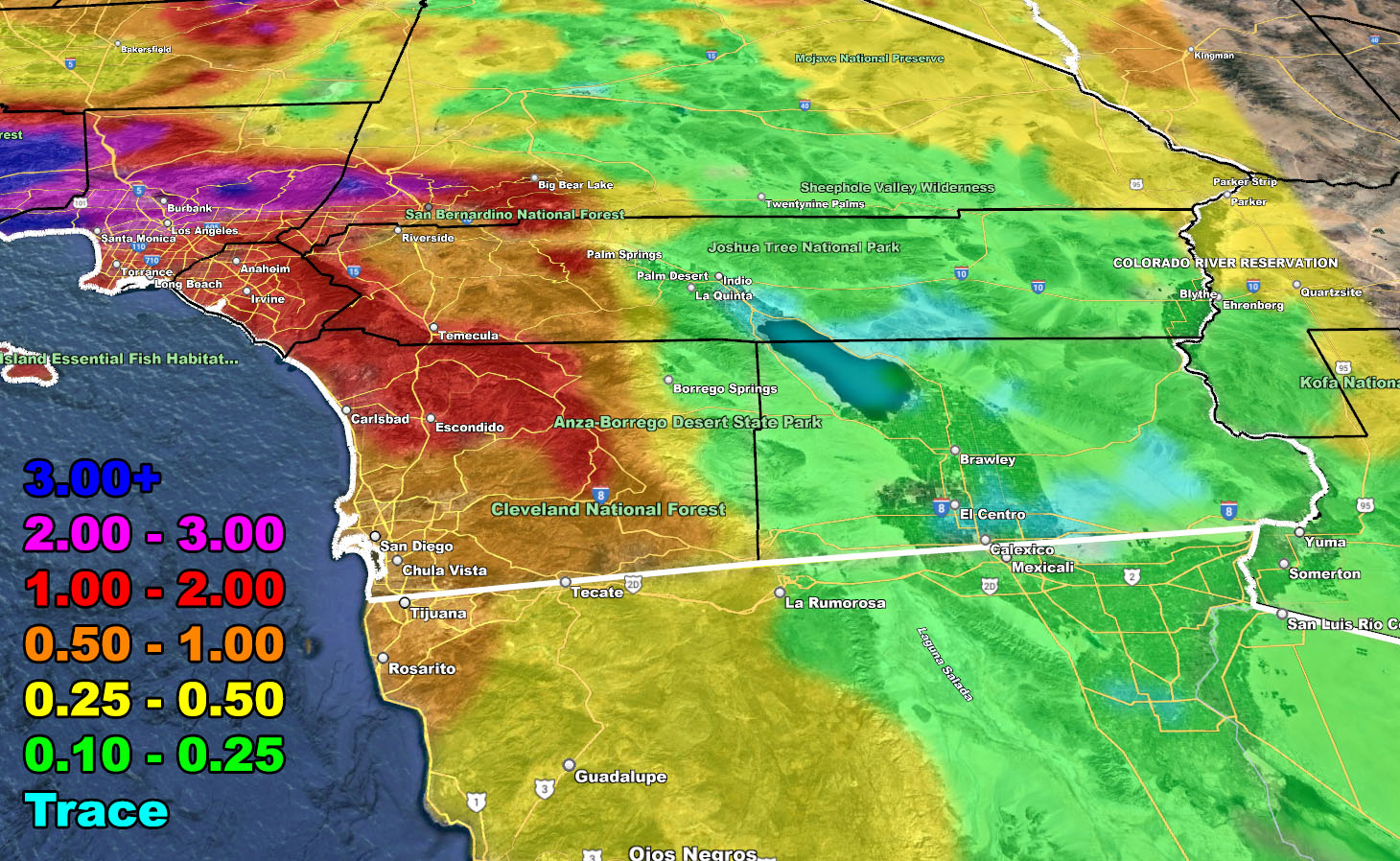
Rain Model – TUESDAY THROUGH WEDNESDAY MORNING 3-15-2023
SUPPORTING MEMBERS: Click Here To See The GPS Version Of This Model In Your Member Section Tab.
MEMBER NOTE: If your account is not working, use the lower right ‘Weather Center Support’ Button to troubleshoot.
Join The Main Southern California Weather Force Facebook Group (50 percent delivery time) – You can join the main SCWF page as well through that group.
Click Here To Join The Page Today