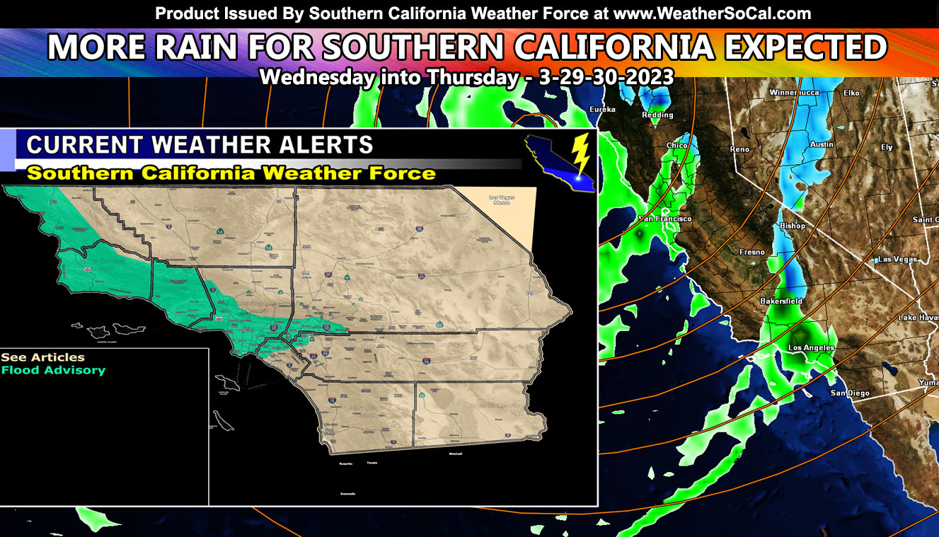
Another storm system is going to move into California, dragging a tail-end Charlie type front through the region on Wednesday and early Thursday. The system has been assigned an average of Category Two out of Six here at Southern California Weather Force. For the rain and snow maps, including the forecast for Opening Day for Baseball on March 30th, read on …
Here are the final keynotes;
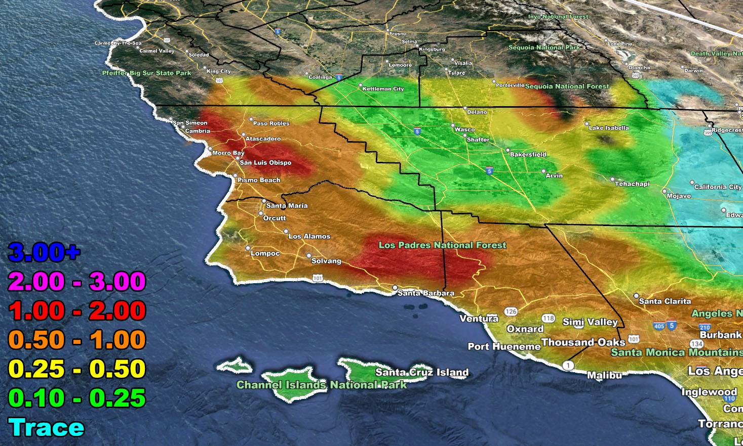
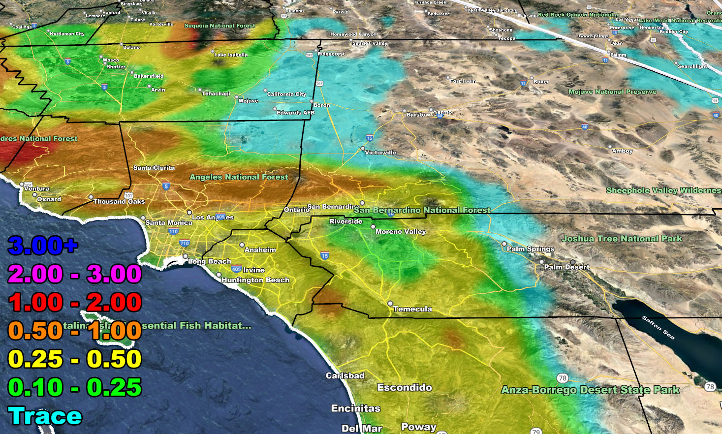
- The system will be the strongest across San Luis Obispo County and start earlier, Tuesday night.
- The system will not need Winter Storm Warnings as it will have two quick moving fronts, most of which will not be strong at all for our mountains. It however does activate my Flood Advisory for parts of the Inland Empire west through LA, Ventura, Santa Barbara, and San Luis Obispo zones.
- SCWF snow models do show some snowfall below 4,000 FT, which means Tehachapi will see some flakes flying Wednesday into Thursday, but again not much at all.
- Thunderstorm chances do exist during the Wed/Thu period from Los Angeles/SCV/SFV west through Ventura, Santa Barbara and San Luis Obispo County, and east to Kern County.
- Gusty mountain and desert winds will accompany the front, neither expected to be damaging like previous storms.
- A category two means it is a weak/moderate system.
- This was the system predicted several days ago at the article by Clicking Here.
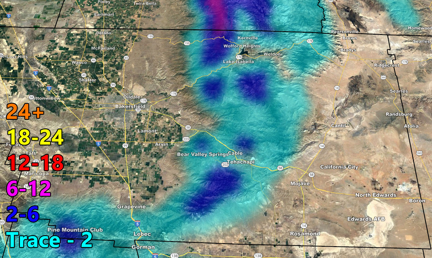
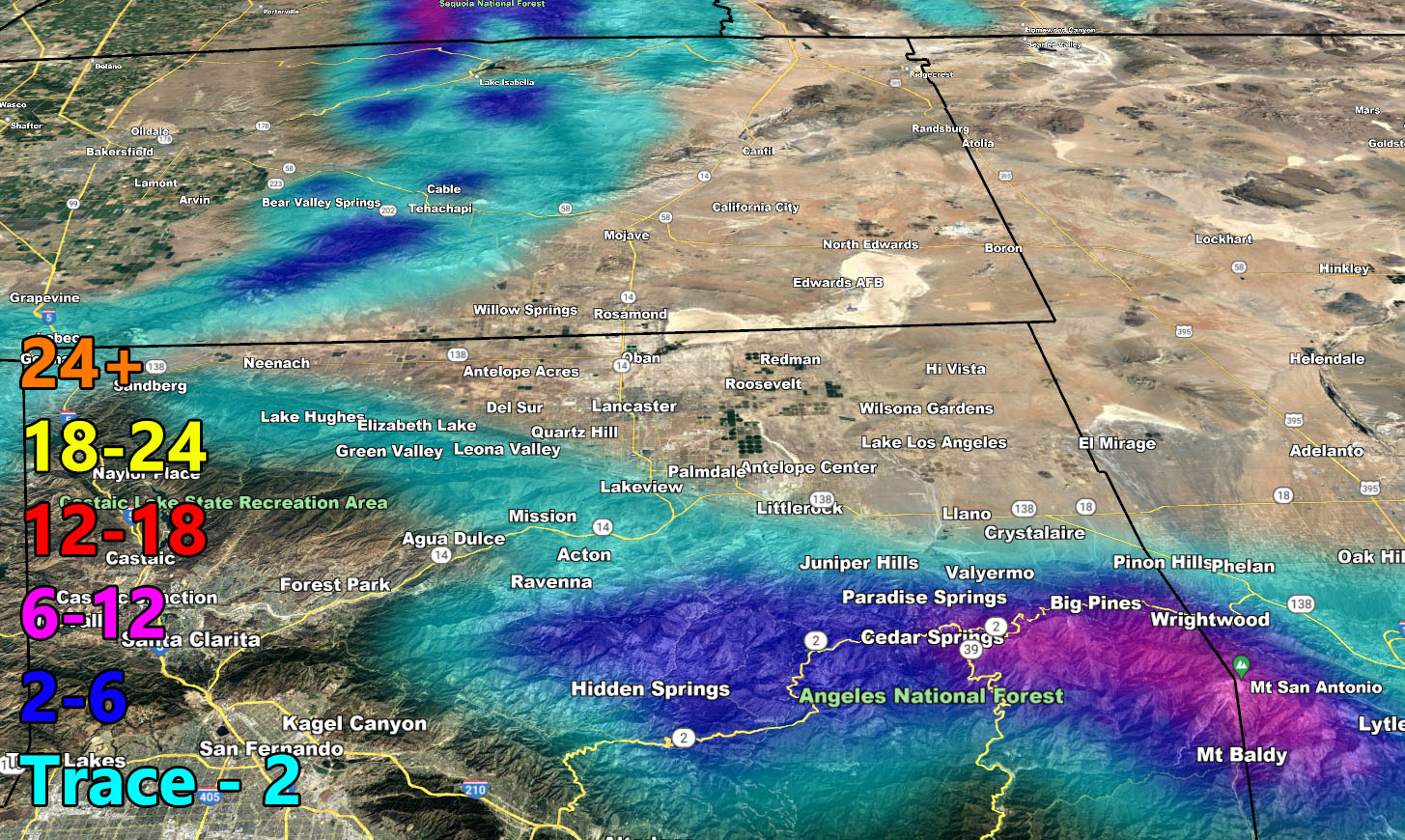
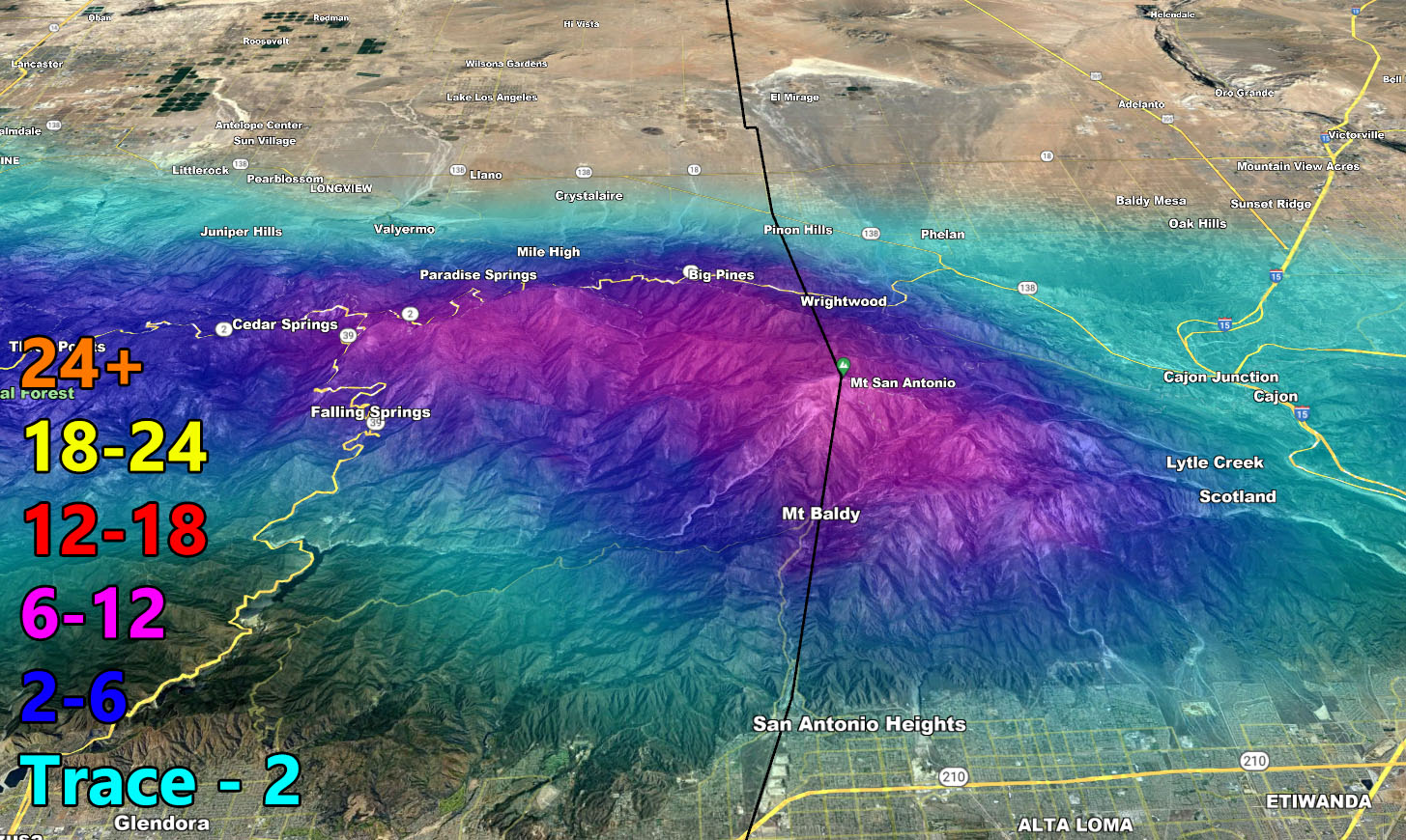
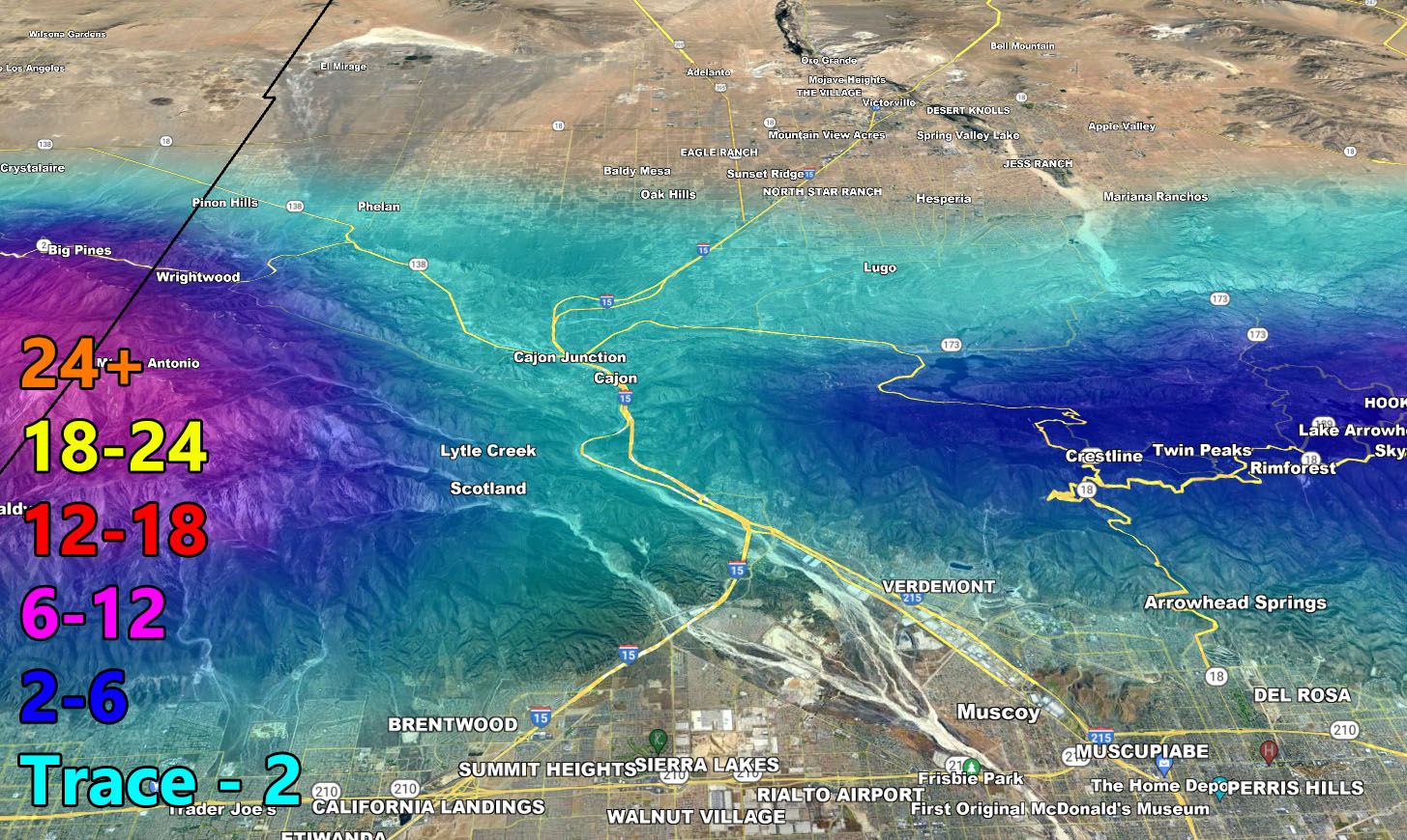
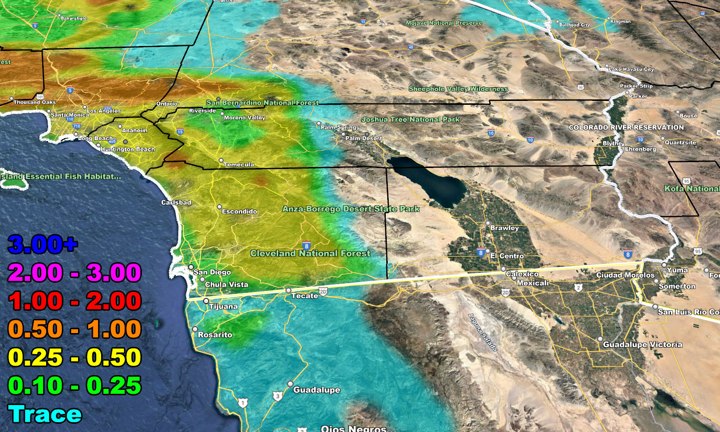
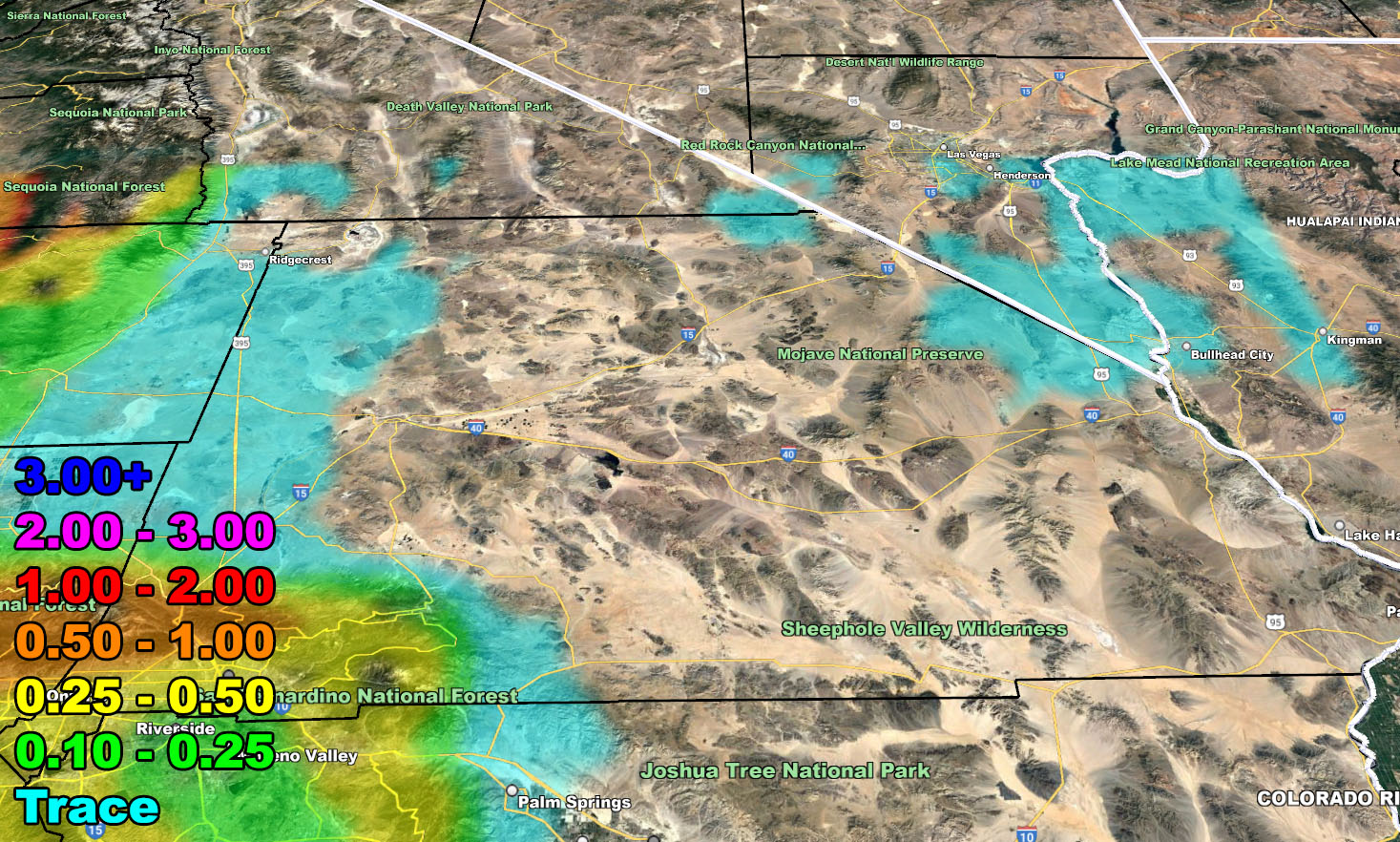
- This is the final forecast for rain and snow models for this system.
BASEBALL OPENING DAY FORECAST: Opening Day is March 30th. I will be making a call that for the forecast area that the last front on Thursday will vacate over the morning, leaving for drier conditions in the LA/SD/OC Stadium zones.
LONG RANGE: We are starting to release the weather pattern so timing between systems will be longer. The next pattern change after a break will be around April 9th, but that would be the 3rd system in my Super Long Range Weather Watch. The watch stated two systems ago that five more will hit before the season is over. We have around three more left.
As for the rest of the system, the informational rain/snow products below will be fine for this forecast.
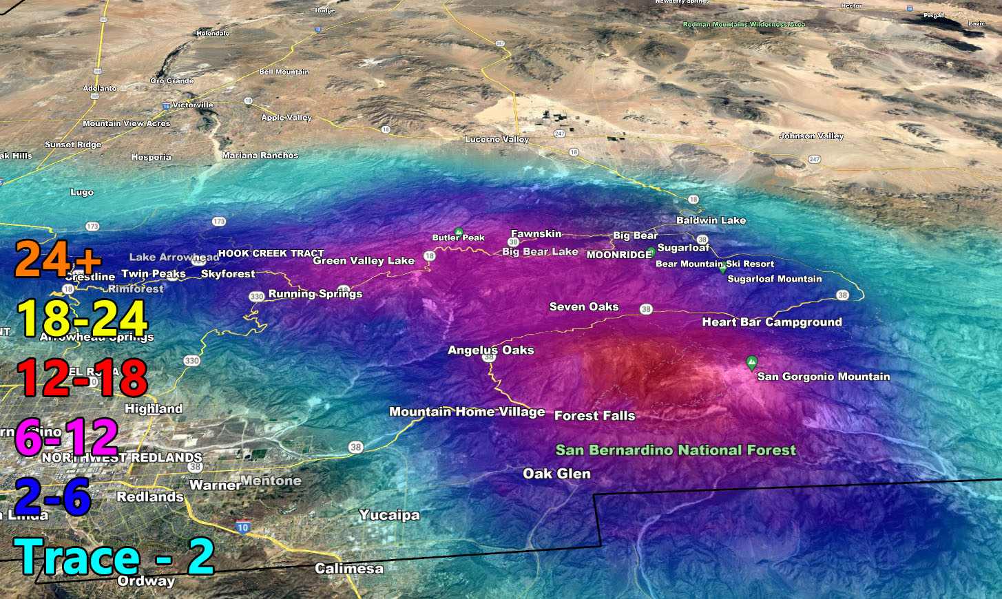
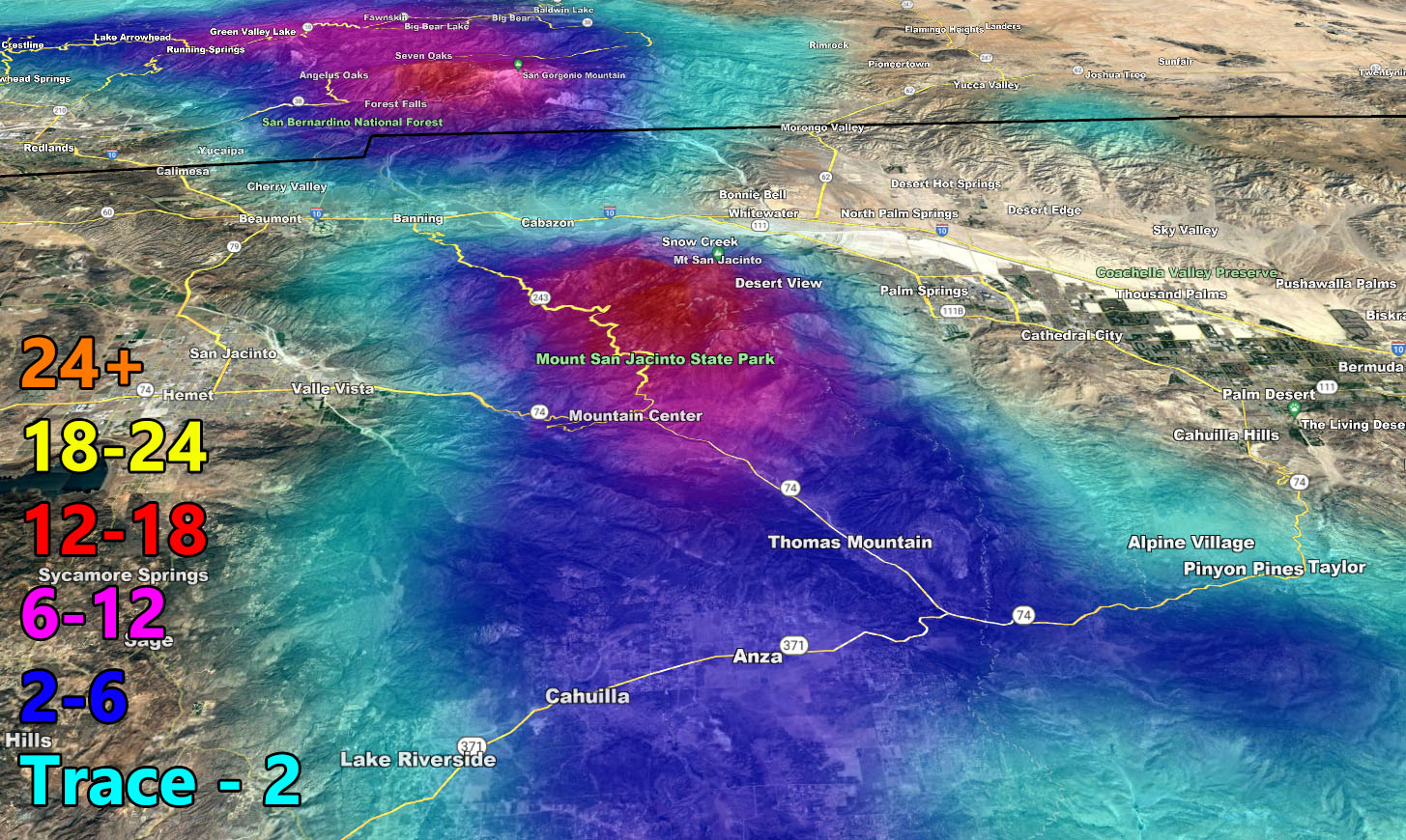
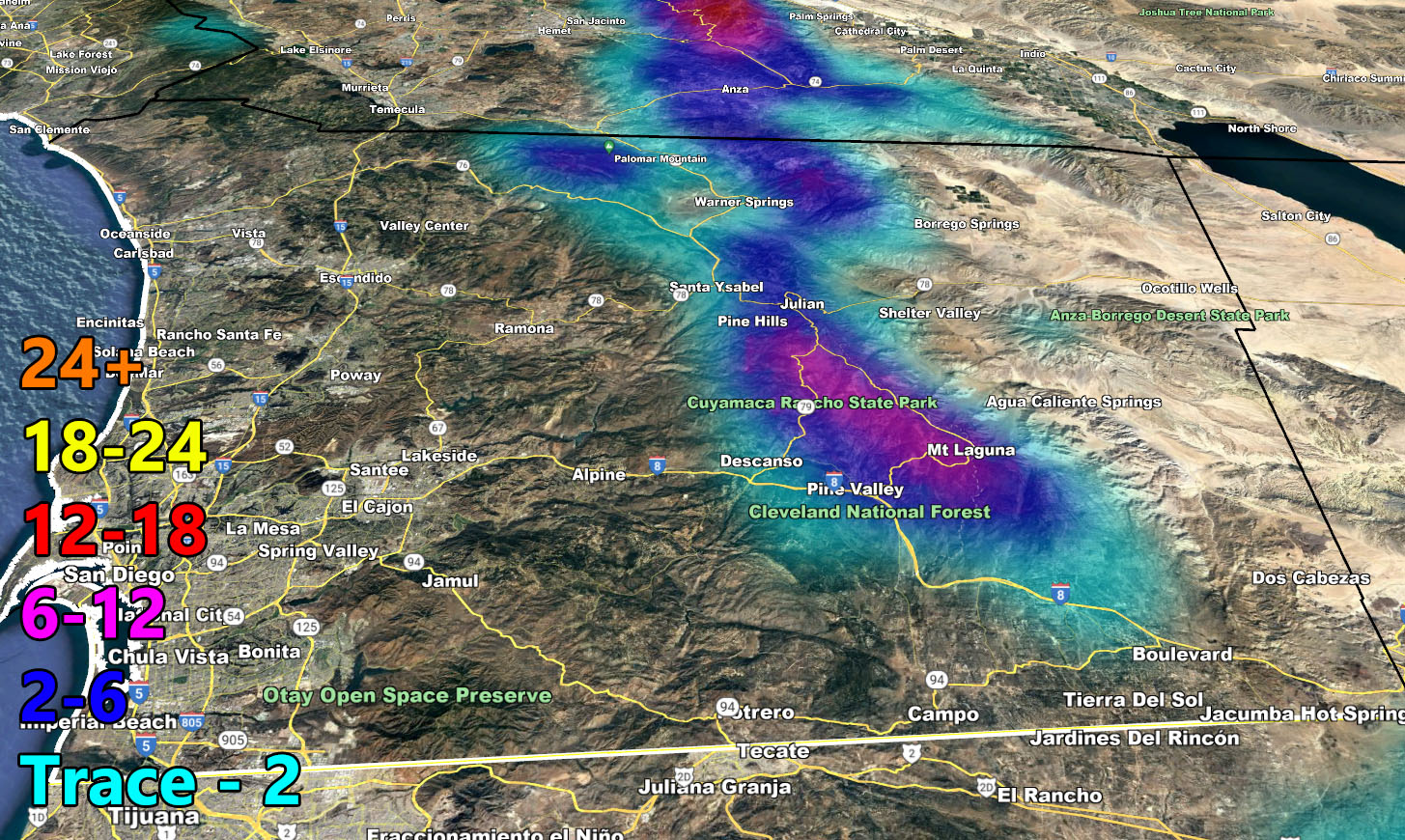
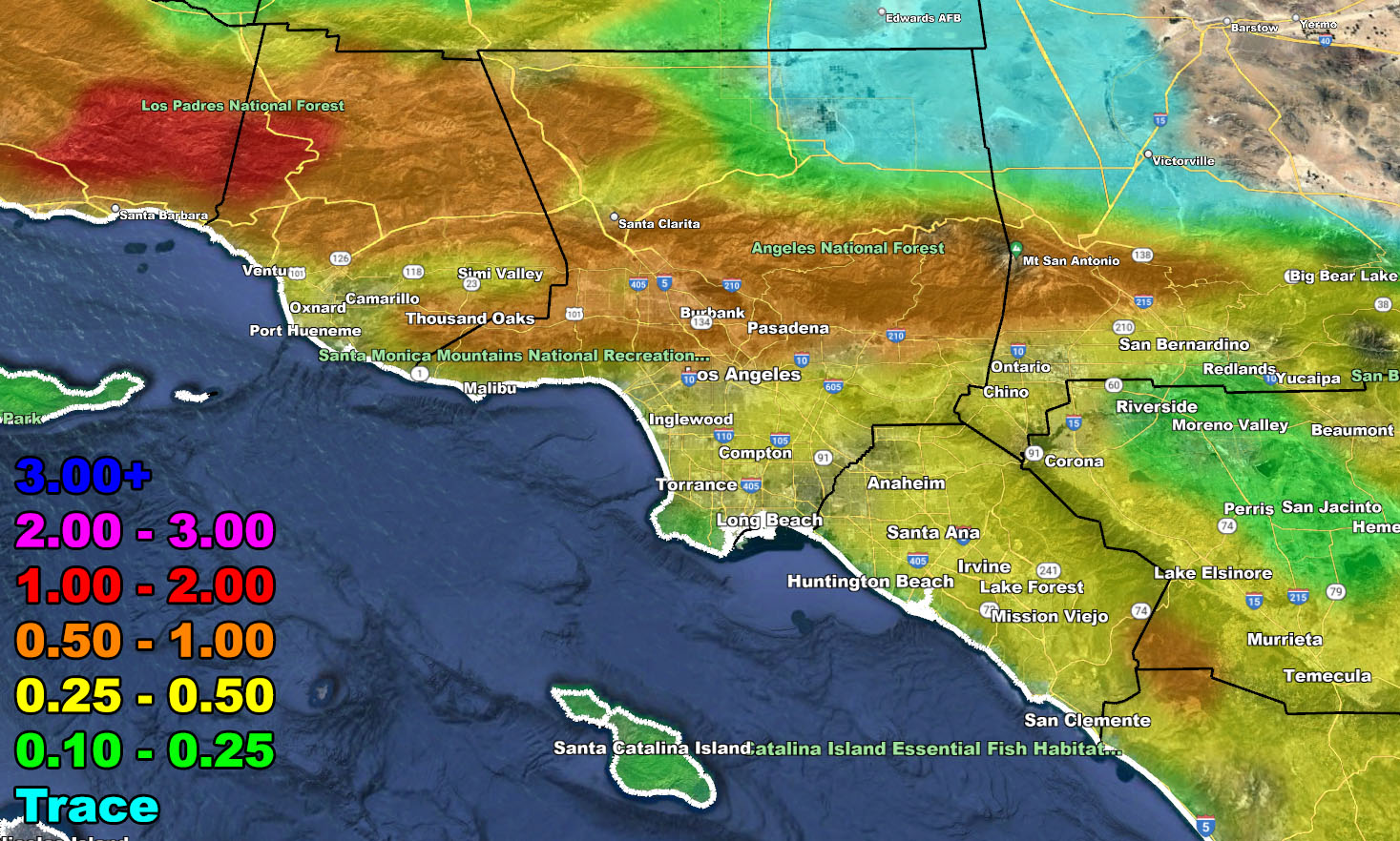
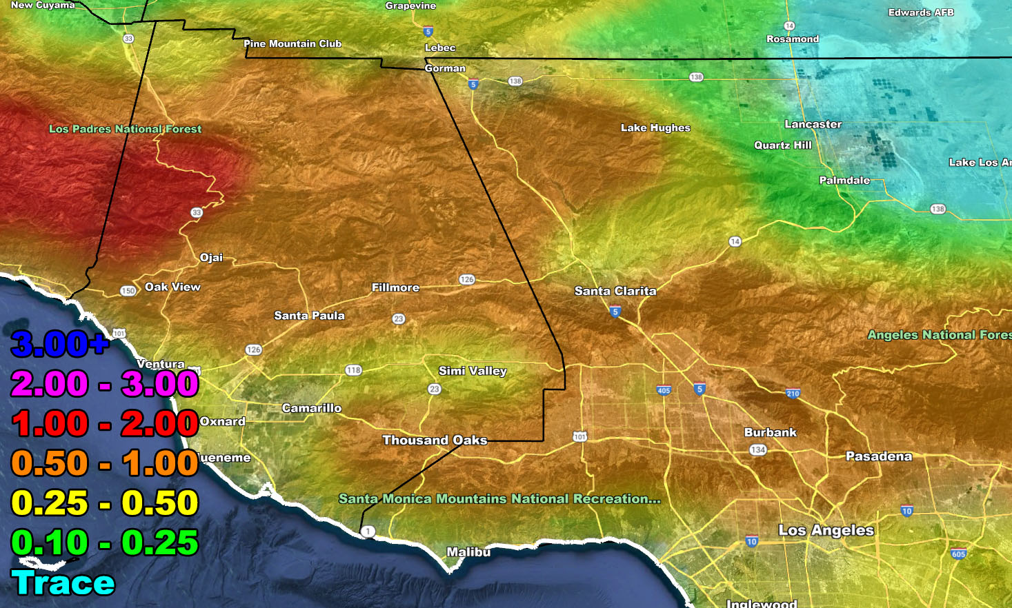
Rain Model – WEDNESDAY INTO THURSDAY 3-29-30-2023
SUPPORTING MEMBERS: Click Here To See The GPS Version Of This Model In Your Member Section Tab.

Snow Model – WEDNESDAY INTO THURSDAY 3-29-30-2023
SUPPORTING MEMBERS: Click Here To See The GPS Version Of This Model In Your Member Section Tab.