
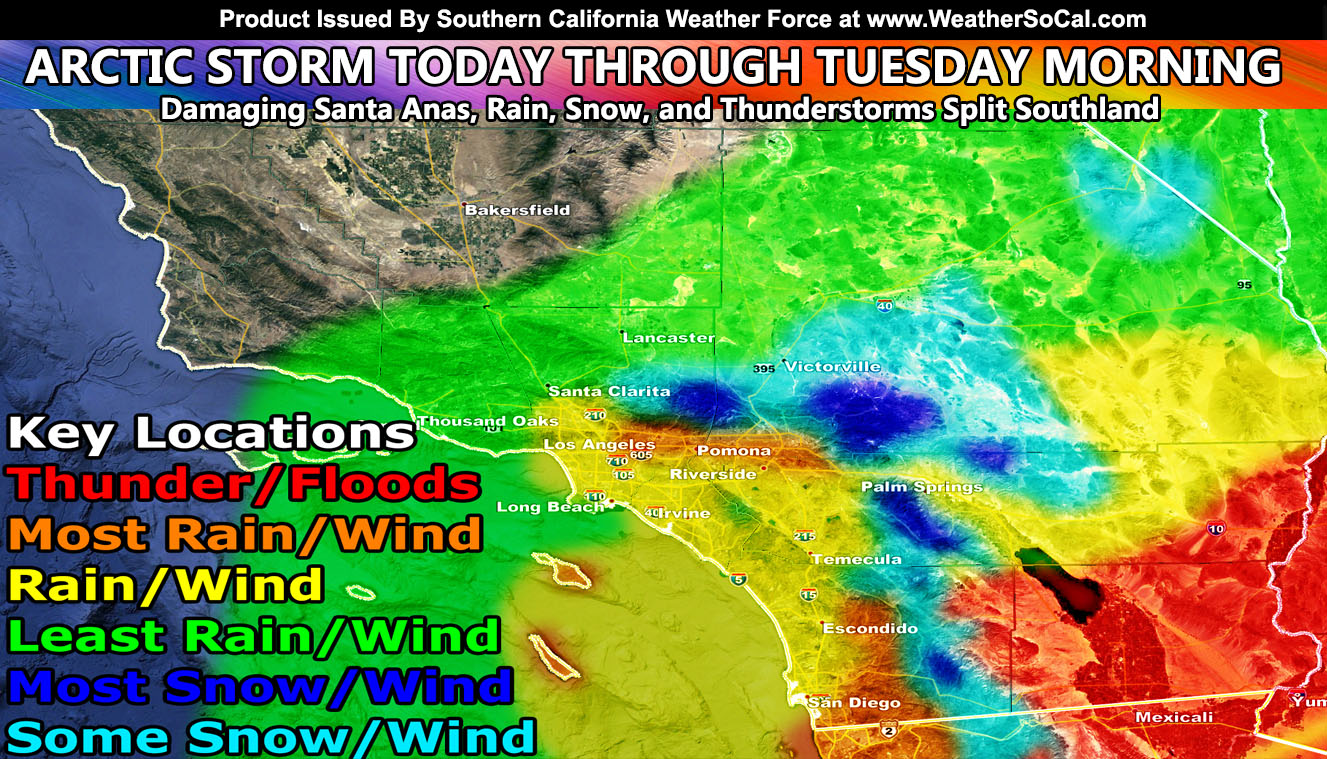
Well as the title suggests this is a micro-climate weather forecast service and an arctic storm will split the zones with some seeing little and some seeing a lot. It will all depend where you are and below in this article update I have issued models for wind, rain, floods, and snow and as expected the activity in LA/OC has started this morning so read on for the full details and grab your zone model. Zones are split with 1,2,3,4 in the models, 1 upper left, 2 upper right, 3 lower left, and zone 4 lower right so remember your zones for future updates …
All alerts issued in the article as well as the model images here at SCWF is over the micro-climate alert email / app notification system.
To consider joining to get these delivered to you without delay, CLICK HERE
Join Southern California Weather Force main Facebook Page for future updates if you haven’t yet!
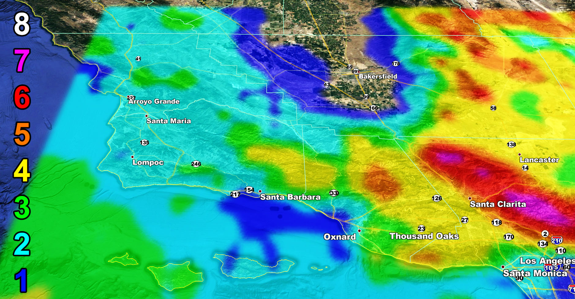
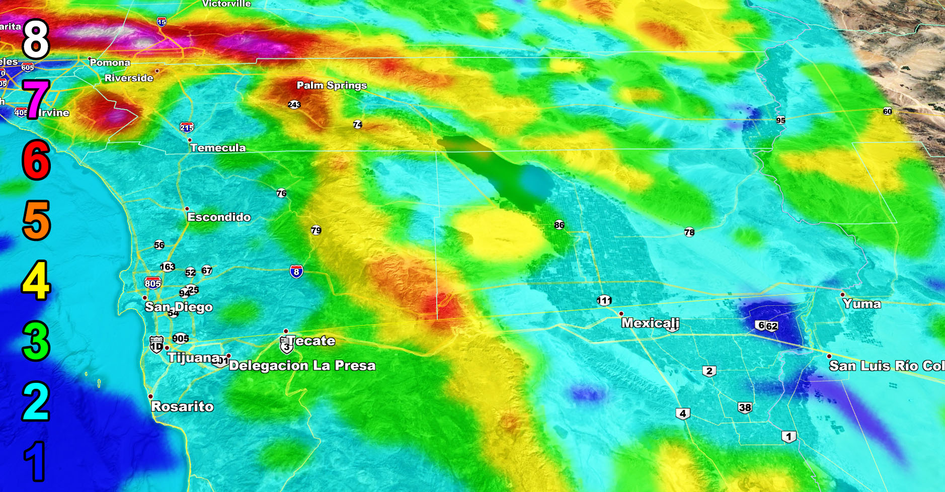
Rain Forecast – The most rain will be across Imperial County and the southern valley/slope zones of the LA/San Bernardino Mountains but use the zone images below for your area.


Flood Forecast – Flood Advisories were issued for this event. Click here to read the one for Los Angeles … Click Here to read the one for Imperial to Blythe


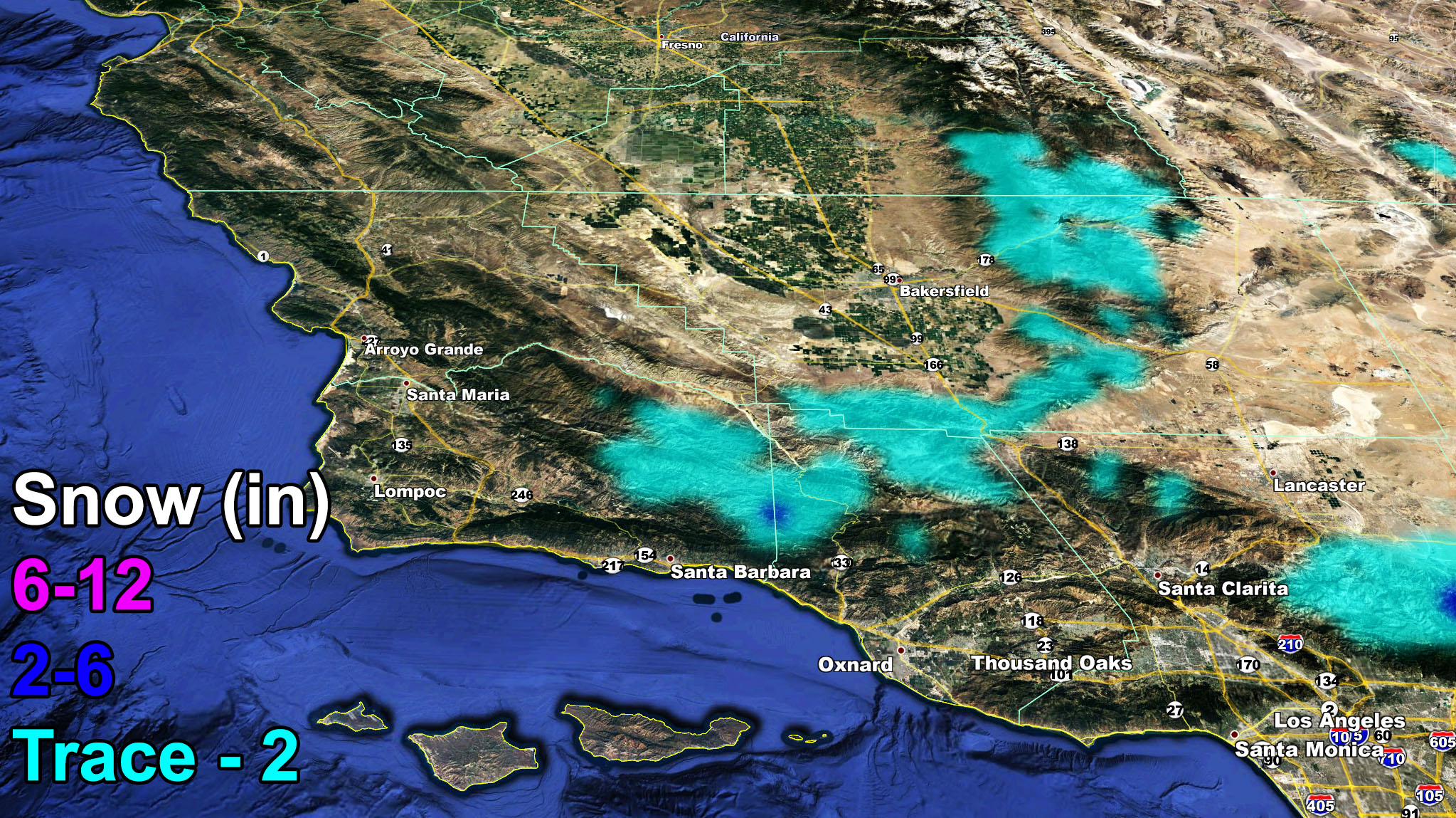
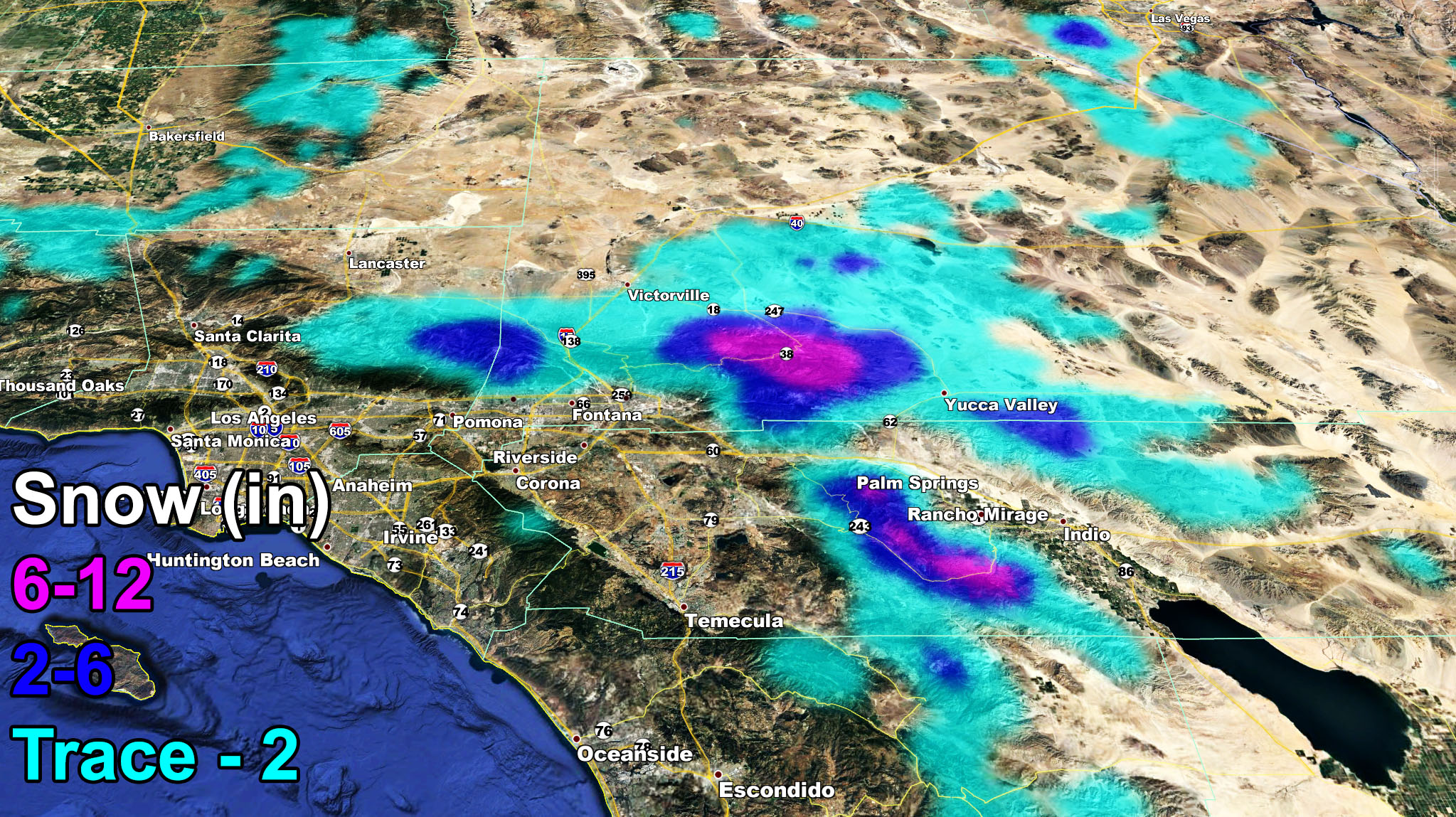
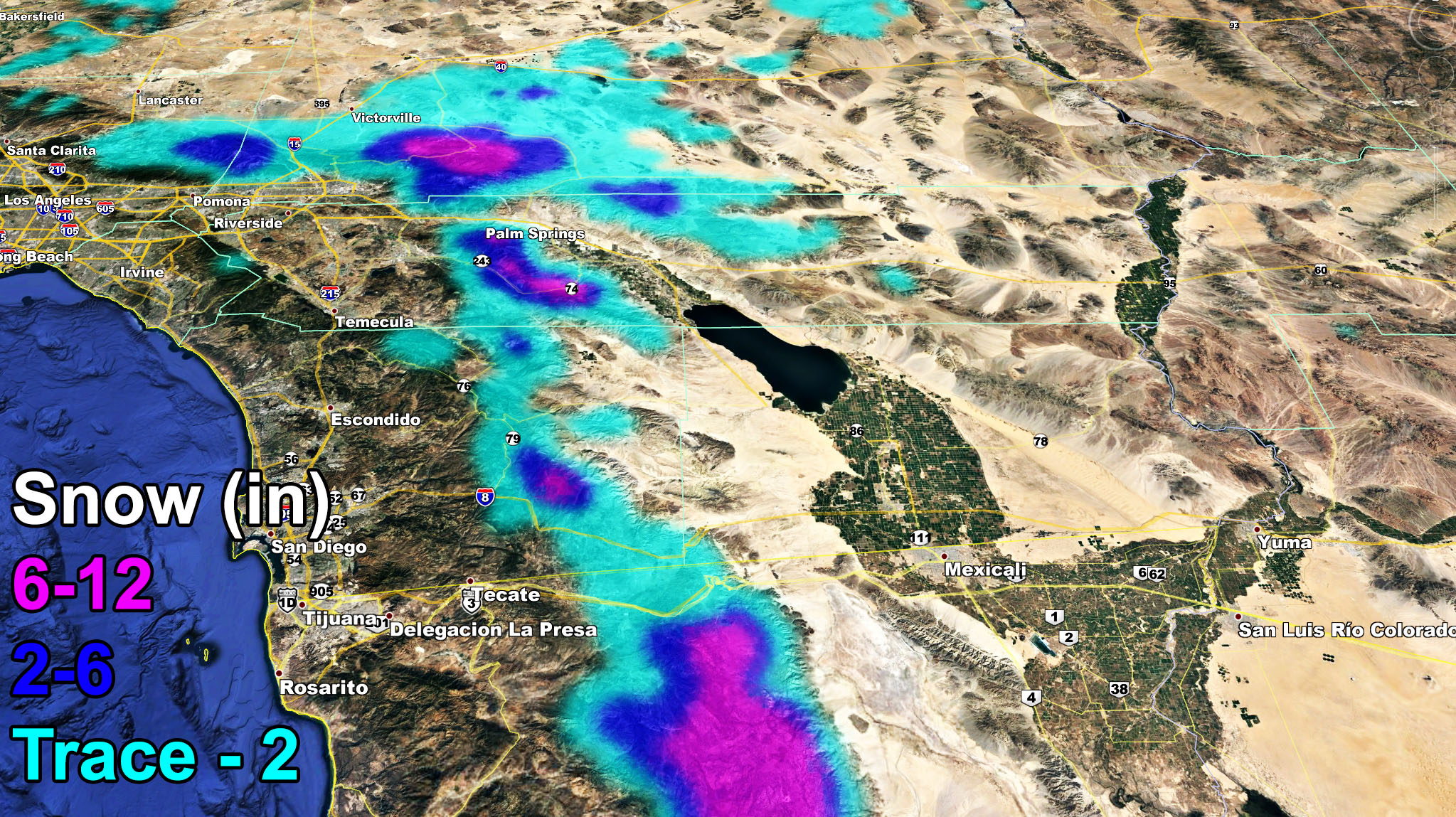
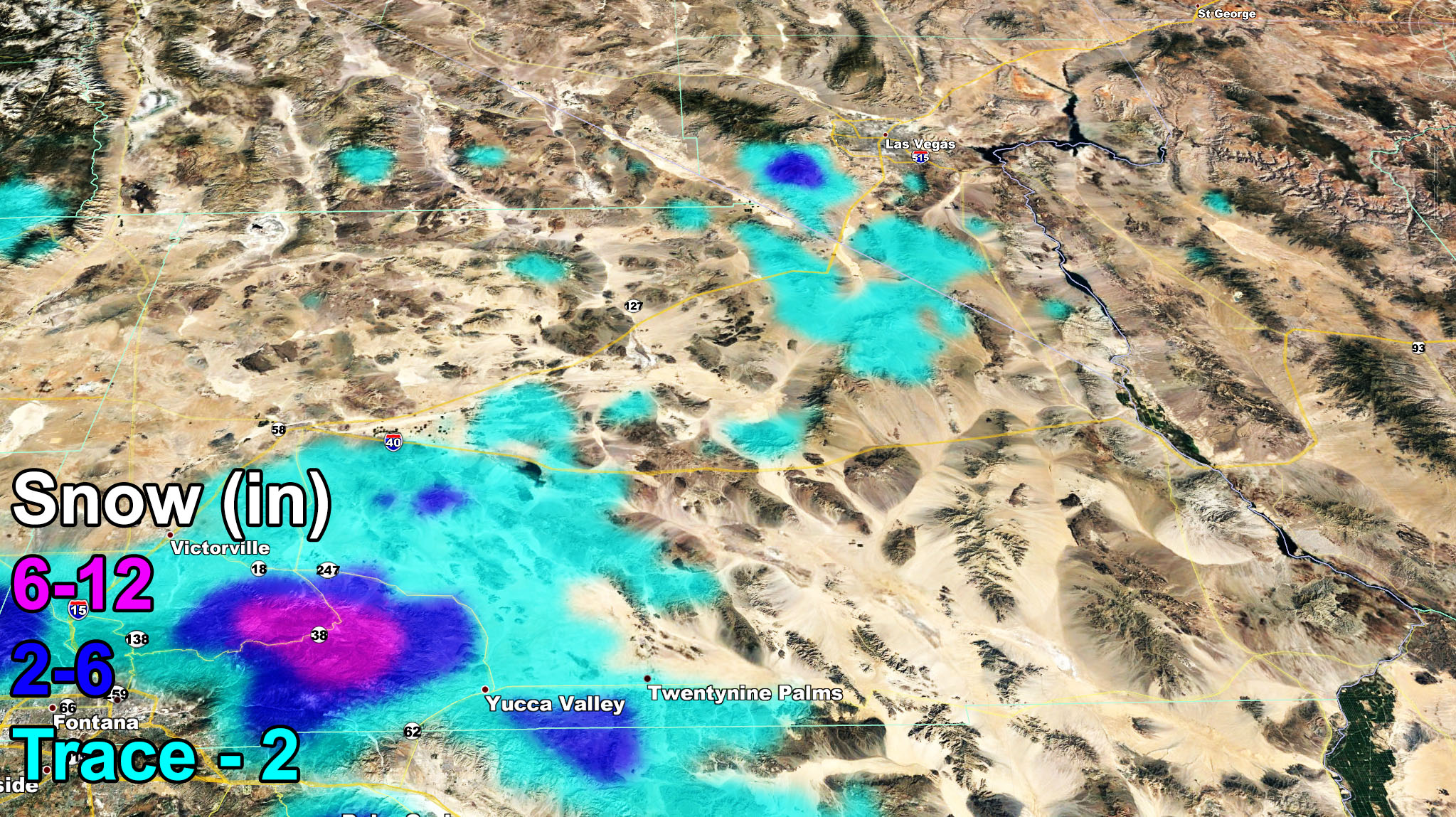
Snow Forecast – A joint Winter Storm Warning and Winter Weather Advisory alert was issued for this event for snow so in conjunction to the models below, Click here to read the alert Note: The Kern County Mountains have a trace-2 outline but the slight eastern movement of the system may keep that down to little or nil. I did not issue an advisory there as a result.
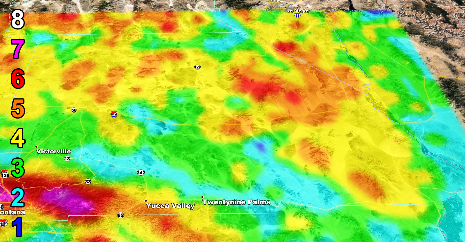
Wind Forecast – Offshore Santa Ana Winds will blow through Tuesday and there will be very strong gusts out there so use the wind model below for those zones. Definitely a Cajon Pass truck tip-over event on a prolonged scale.
Martin Wind Gust Intensity Scale –
8. Extensive widespread damage.
7. Trees are broken or uprooted, building damage is considerable. – High Profile Vehicle Roll-Over CERTAIN.
6. SOME Trees are broken or uprooted, building damage is possible. – High Profile Vehicle Roll-Over Likely, Do NOT recommend Traveling in this zone
5. Slight damage occurs to buildings, shingles are blown off of roofs. HIGH WIND WARNING CRITERIA – High Profile Vehicle Roll-Over Possible if weight is not corrected.
4. Twigs and small branches are broken from trees, walking is difficult.
3. Large trees sway, becoming difficult to walk. POWER SHUTDOWN THRESHOLD during any high fire risk. WIND ADVISORY CRITERIA
2. Large tree branches move, telephone wires begin to “whistle”, umbrellas are difficult to keep under control.
1. Small trees sway.

Join Southern California Weather Force main Facebook Page for future updates!
MICRO-CLIMATE ALERT FACEBOOK GROUPS: Find yours today!
Click here to join
Reading for another state? Join my national page – https://www.facebook.com/nwfweather/
All articles and micro-climate alerts can be delivered to you via the app/email alert service subscription so Click Here To Check It Out And Join Today and NEVER miss a beat
MICRO-CLIMATE ALERT FACEBOOK GROUPS: Find yours today!
Click here to join
As always, stay tuned to official forecasts from Southern California Weather Force for updates …
For The Main Weather Facebook Page Click Here and Join.
End Article
FACEBOOK PAGES TO JOIN!
SOUTHERN CALIFORNIA WEATHER FORCE MAIN: Southern California Weather Force Office Main Page
BEHIND THE SCENES FORECASTS/UPDATE PAGE: Southern California Weather Force Meteorologist Page
FOR THE CALIFORNIA FAULT STRESS MODEL PAGE: For SCWF official updates to the California Fault Stress Model and more!
“PONDER THIS” SCIENCE ADVENTURE SHOW: A science adventure show developed here at Southern California Weather Force that is a fun ride!
INSTAGRAM AND TWITTER ACCOUNTS TO JOIN!
Instagram – https://www.instagram.com/socalweatherforce/
Twitter – https://twitter.com/SCweatherforce