Author: Weather Force

New Product Model Update Announcement – 1-29-2021 – Effective in service now.

New Product Model Update Announcement – 1-29-2021 – Effective in service now.

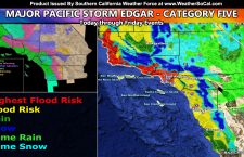
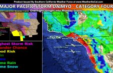
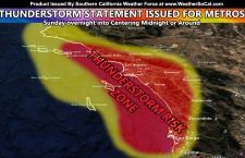
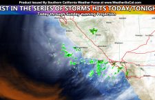
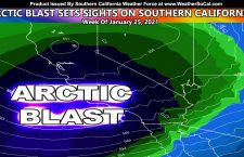
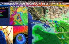
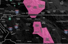
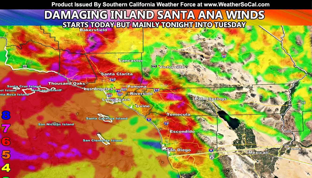
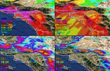
  This is a single four-panel image discussion so read on for those details on what image means what. You can comment below your thoughts on it if you wish. If you’re in a rain-shadowed area, these will be valuable. Just like the weather, here at Southern California Weather Force things are ever-changing to make things better and more accurate. […]

Read more ›
FINAL FORECAST: Major Pacific Storm EDGAR Impacts Southern California as a Category Five Starting Later Today, Goes Through Friday; Complete Model Image Suite

FINAL FORECAST: Major Pacific Storm EDGAR Impacts Southern California as a Category Five Starting Later Today, Goes Through Friday; Complete Model Image Suite

Major Pacific Storm EDGAR has been assigned a Category Five here at Southern California Weather Force and will impact the metros later today, into tonight, and through Friday in multiple impulses in what will be the strongest system precip-wise of the year.  We usually get one each season and it is based on the flood risk, wind risk, thunder risk, […]

Read more ›
FINAL FORECAST: Major Pacific Storm DAIMYO impacts Southern California Starting Tonight, Goes Through Monday; Complete Model Image Suite

FINAL FORECAST: Major Pacific Storm DAIMYO impacts Southern California Starting Tonight, Goes Through Monday; Complete Model Image Suite

Major Pacific Storm DAIMYO has been upgraded to a category four out of six system in certain areas due to the combination of thunderstorms, heavy rain or snow, and very gusty winds behind the front that will bring trees or power poles down in spots.  This is the final forecast in the series of storms in the Martin Storm Pattern, […]

Read more ›
Thunderstorm Statement Issued Ahead Of Pacific Storm Daimyo; Expected Punch In The Face Type Front Overnight on Sunday

Thunderstorm Statement Issued Ahead Of Pacific Storm Daimyo; Expected Punch In The Face Type Front Overnight on Sunday

Southern California Weather Force has issued a Thunderstorm Statement out ahead of a fast-moving punch in the face type cold-front expected into the metros overnight on Sunday.  Read on for details … Pacific Storm Daimyo will start off as a category three with room to obtain category four status if thunderstorm dynamics remain in play along with gusty winds along […]

Read more ›
Today through Sunday evening Rain and Snowfall Projection On First System of Multiple Into Southern California

Today through Sunday evening Rain and Snowfall Projection On First System of Multiple Into Southern California

A front is coming into the area, but it’ll cut off to the south of here and wrap-around moisture will bring the rain/snow to the region.  These are the project images from the SCWF model for rain and snow.   Noting the Cajon and Gorman Pass will see a bit of snowfall with this system.  Stronger systems will hit as we […]

Read more ›
Arctic Blast Sets Sights On Southern California This Next Week; Low Elevation Snowfall Possible

Arctic Blast Sets Sights On Southern California This Next Week; Low Elevation Snowfall Possible

A cold pattern that will bring a couple of arctic fronts through Southern California will be the coldest of the season thus far and lies within my forecast a couple of months ago about this season having low elevation snowfall with pending Pacific Storm Diamyo so read on for details … Pacific Storm COVID lived up to the name.  Winding […]

Read more ›
Damaging Santa Ana Winds Peaking Today Along With A Winter Storm Warning Issued for The Big Bear Areas With Storm Window Opening Last 10 Days Of The Month

Damaging Santa Ana Winds Peaking Today Along With A Winter Storm Warning Issued for The Big Bear Areas With Storm Window Opening Last 10 Days Of The Month

The damaging Santa Ana Wind Event is underway, with strengthening east winds for more widespread reports through this afternoon and evening.  The Los Angeles Basin is breezy right now, but expecting an increase to advisory level gusts this afternoon/evening.  The SCWF Winter Storm Warning is in effect for the Big Bear areas and the Mt. San Jacinto areas through Wednesday.  […]

Read more ›
Winter Storm Warning

Winter Storm Warning

Issued Zones:  Big Bear … Riverside Mountains … Site:  Southern California Weather Force has issued a Winter Storm Warning effective this afternoon through Wednesday … Date:  1/19/21 at 10:10am PT Forecast: An inside slider is sliding south of the area now and wrap-around moisture is expected to hit the warning area by this afternoon, lasting through Wednesday.  Heavy snowfall will […]

Read more ›
FINAL WARNING UPDATE.. YUCAIPA LAST WARNING: IMMINENT SANTA ANA WIND WARNING PDS: …

FINAL WARNING UPDATE.. YUCAIPA LAST WARNING: IMMINENT SANTA ANA WIND WARNING PDS: …

FINAL FORECAST WARNING… My mom lives in Yucaipa so I pay attention to that area like I did the September fires…  If you don’t want a trampoline blown and given to a neighbor … look at the last picture…  it’s coming. Today is an appetizer to these areas as you’ll see 1/3 today in the same areas compared to tonight […]

Read more ›
wp_footer();