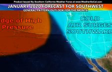
Winter Weather Advisory
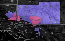
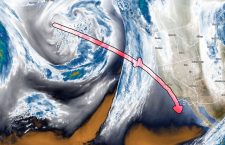
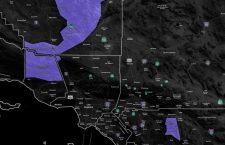
Issued Zones: Kern Mountains … Riverside Mountains … Site: Southern California Weather Force has issued a Winter Weather Advisory effective Thursday. Date: 1/8/20 at 6:45pm PT Forecast: An inside slider will come into the area on Thursday. It will drop snow on various parts, some seeing a dusting, others more than 2-6″ and in some areas up to 6″. Use […]
Read more ›